Last night I gave a talk at Wavelength Brewing Company in Vista, California. They live-streamed the event through their Facebook page and you can watch it here:
Showing posts with label cities from space. Show all posts
Showing posts with label cities from space. Show all posts
Saturday, June 25, 2016

Sunday, May 3, 2015
Night Flights - Spring, 2015
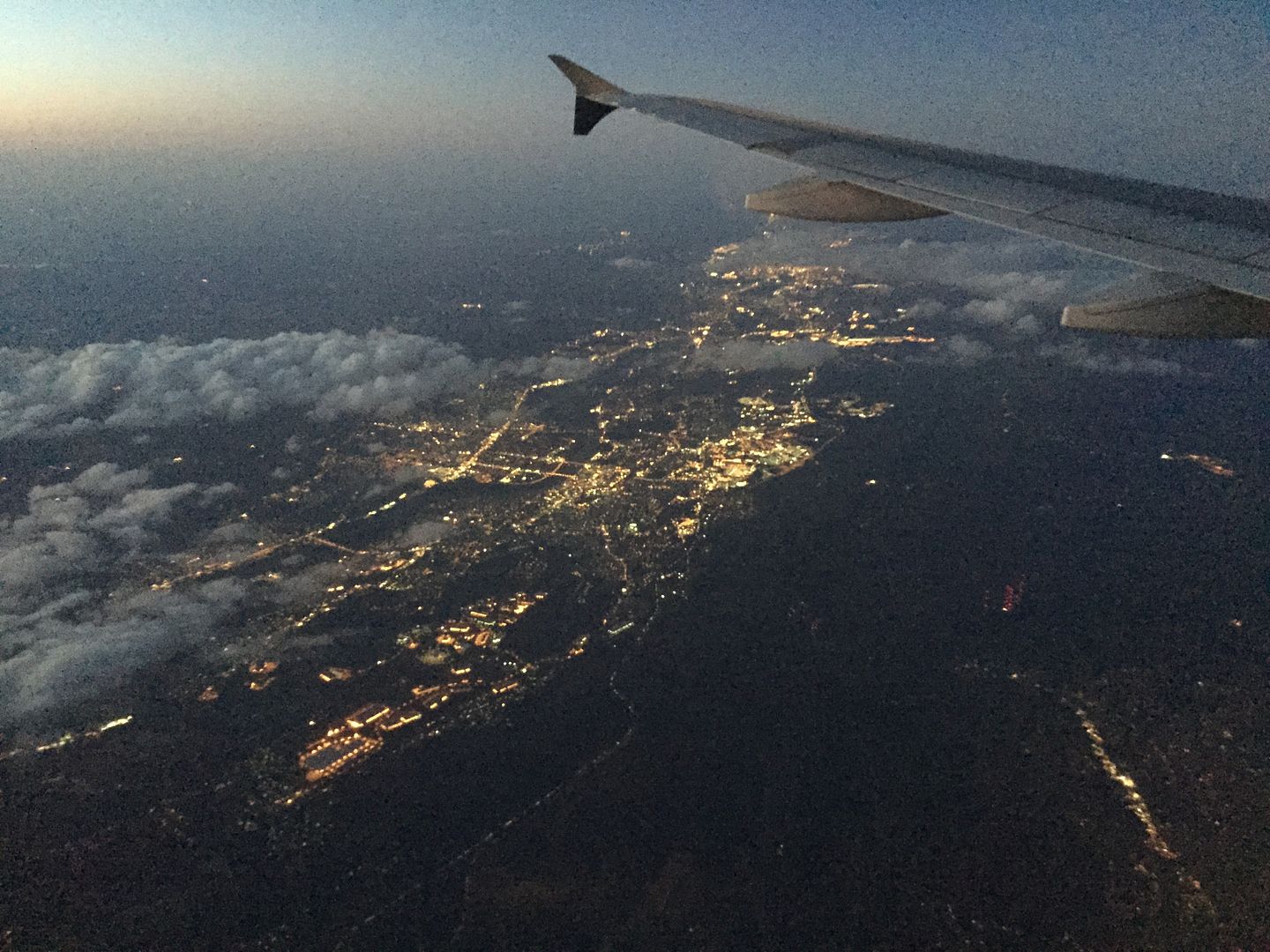
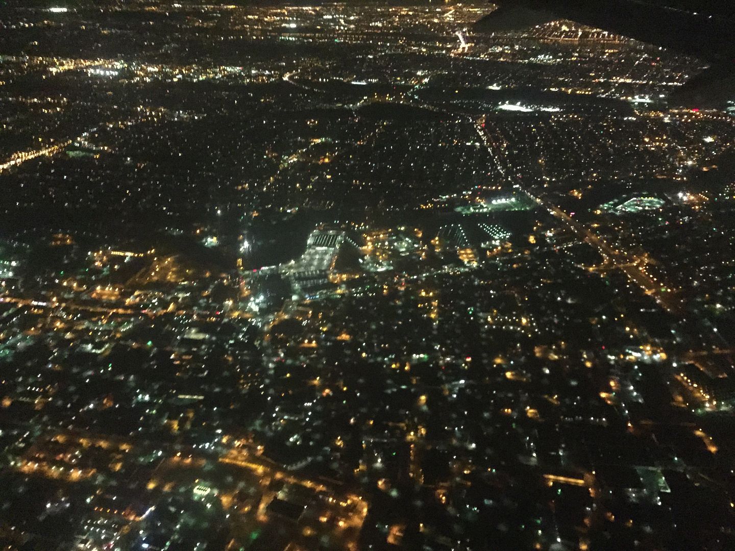
In April, I flew to Newark, New Jersey to attend the Northeast Astronomy Expo (NEAF) and the annual board meeting of the Astronomy Foundation. As I got closer to my destination, darkness was falling and I took advantage of my window seat to take iPhone pics of the city lights below.
 According to the location info that came with the pic, the shot above shows Solcum, Pennsylvania. It was taken in twilight, while it was still light enough to see the wing of the plane, the sky and the clouds illuminated naturally.
 Above, the many lights of Hackensack, New Jersey.
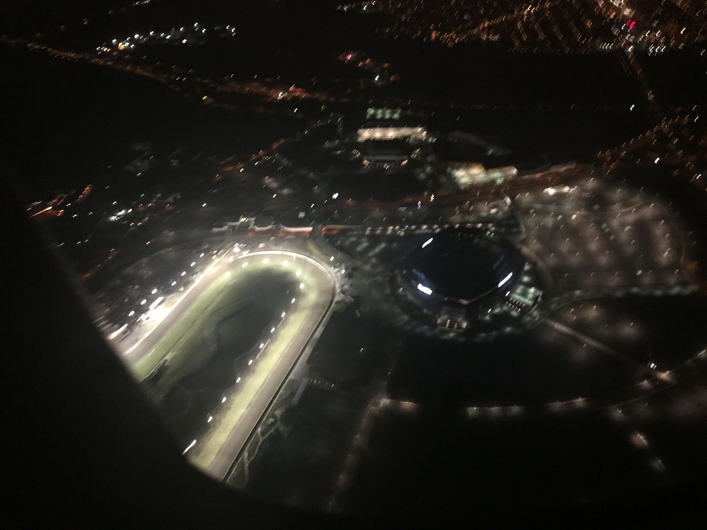
 On our approach to Newark, we passed almost directly above the Meadowlands Racetrack. As you can see, it is crazy bright. Which makes sense if, you know, you are racing at night. I didn't see any signs of activity though, which made me wonder why all the lights were turned on. The track is bright enough at night to be seen from space - more on that in a moment.
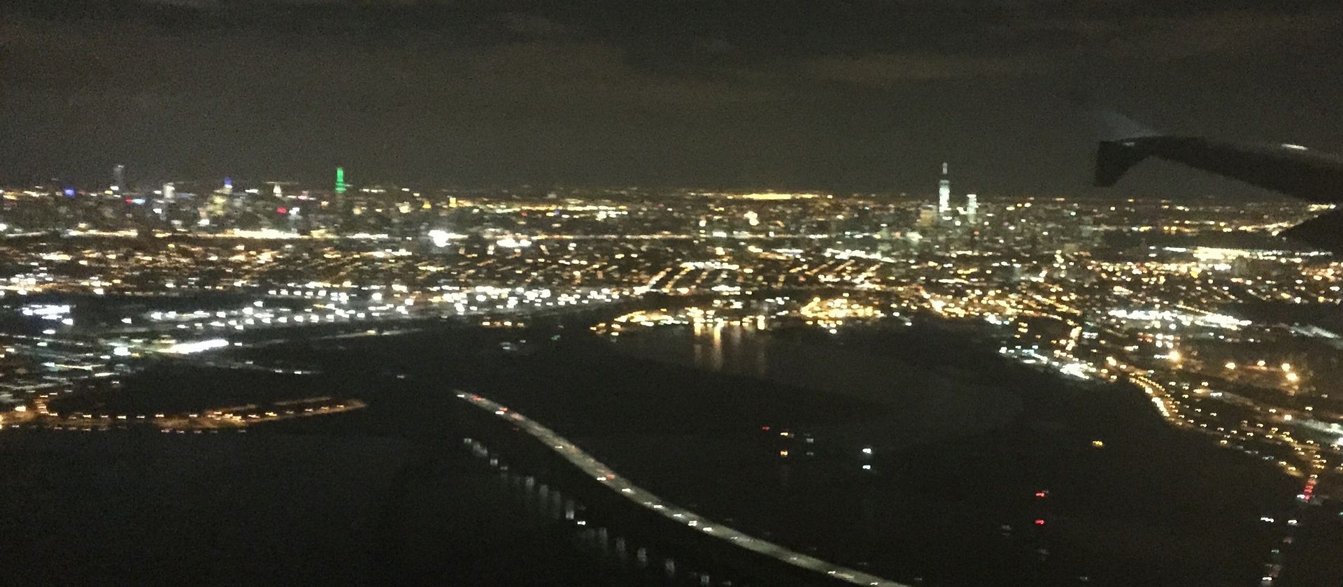
 I also had a this great, but not especially close, view of the New York City skyline. That's the Empire State Building near the left lit up in green. My geography of Manhattan is a bit weak, so I leave the identification of the other tall buildings as an exercise to the reader.
While we're here, let's check out the last two scenes from space.
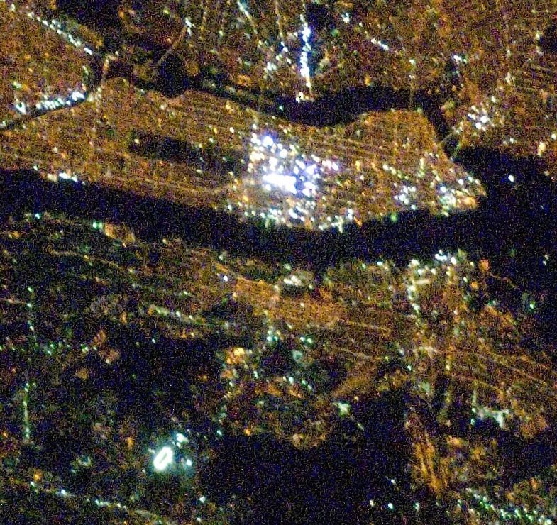
I used this pic in my Times Square from Space post from a few years ago, but it's worth seeing again. The photo was taken from the International Space Station & I've cropped it from the full frame and North is to the left (sorry). The Meadowlands Racetrack is easily visible as a bright oval in the lower left. Across the dark Hudson River lies the very brightest section of NYC and just to the left of that is the relatively dark rectangle of Central Park. The orange color that is virtually everywhere comes from high-pressure sodium streetlights. NYC is in the process of converting their lights from their existing orange lights to white LED. For good reasons not everybody is happy about it, and it will be interesting to see how the view from space changes as the conversion happens.
Earlier this week I had a window seat on a night flight from Phoenix Sky Harbor Airport to San Diego's Lindbergh Field. Naturally, I grabbed my iPhone and took pics of the city lights on this flight too.
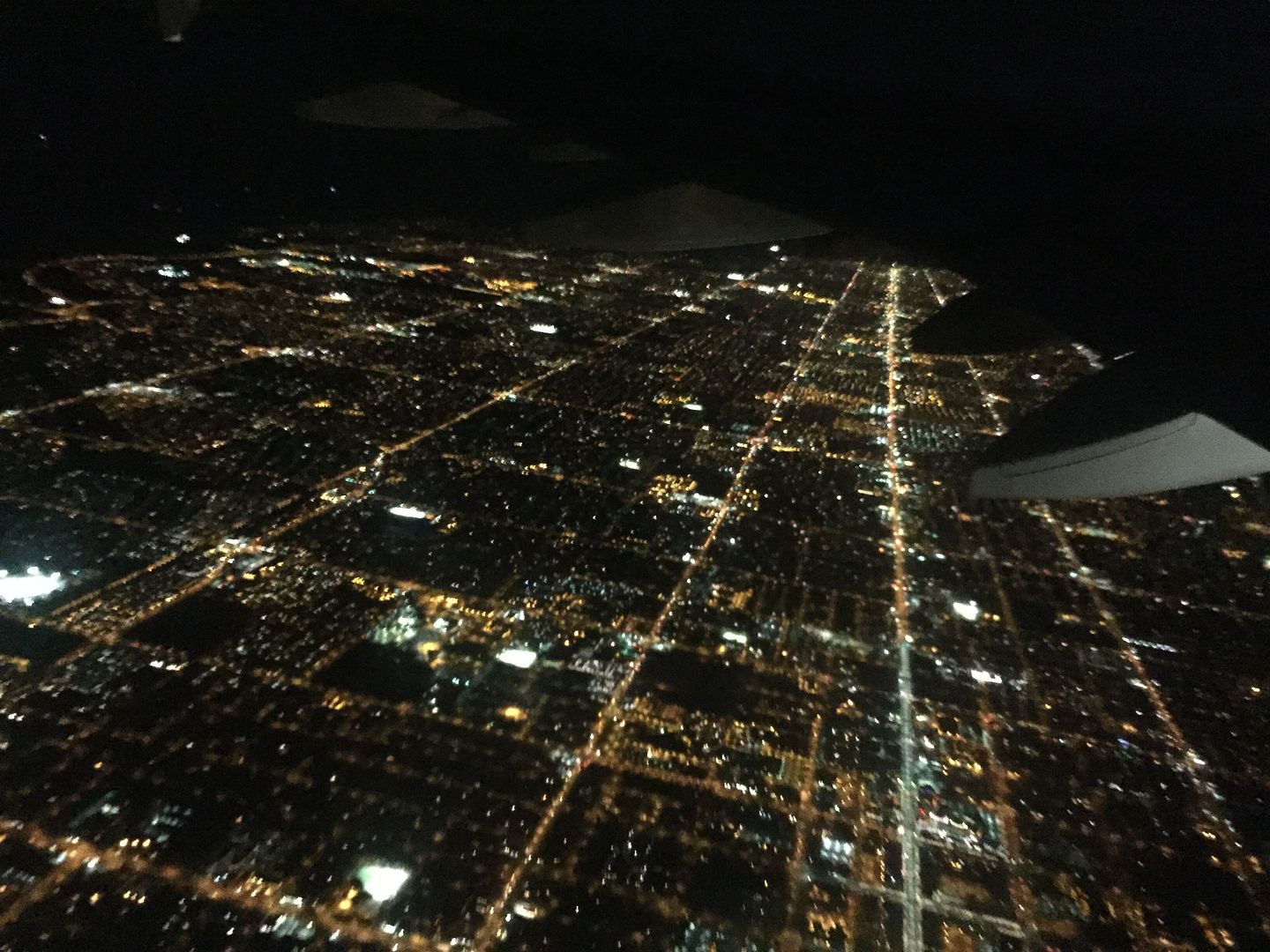
 That's the Phoenix area above. Unlike many cities that grow around many geographic features, the "Valley of the Sun" is laid out in a vast, regular grid pattern that's easily seen here. The occasional bright, white splotches of light are sports fields which are illuminated at much higher levels than other parts of the community. Such sports fields often contain unshielded light and shine light directly upwards creating glare that can be seen from inside aircraft flying at night. Such upward shining light is wasteful and a source of light pollution.
Like NYC, Phoenix is about to undergo a conversion to LED streetlights. In a couple of years the city should look completely different at night. In spite of the claims that are made, LED streetlights are likely to create more light pollution than what is already in place.
While I enjoyed seeing Phoenix at night, I was more interested in seeing the U.S. - Mexico border.
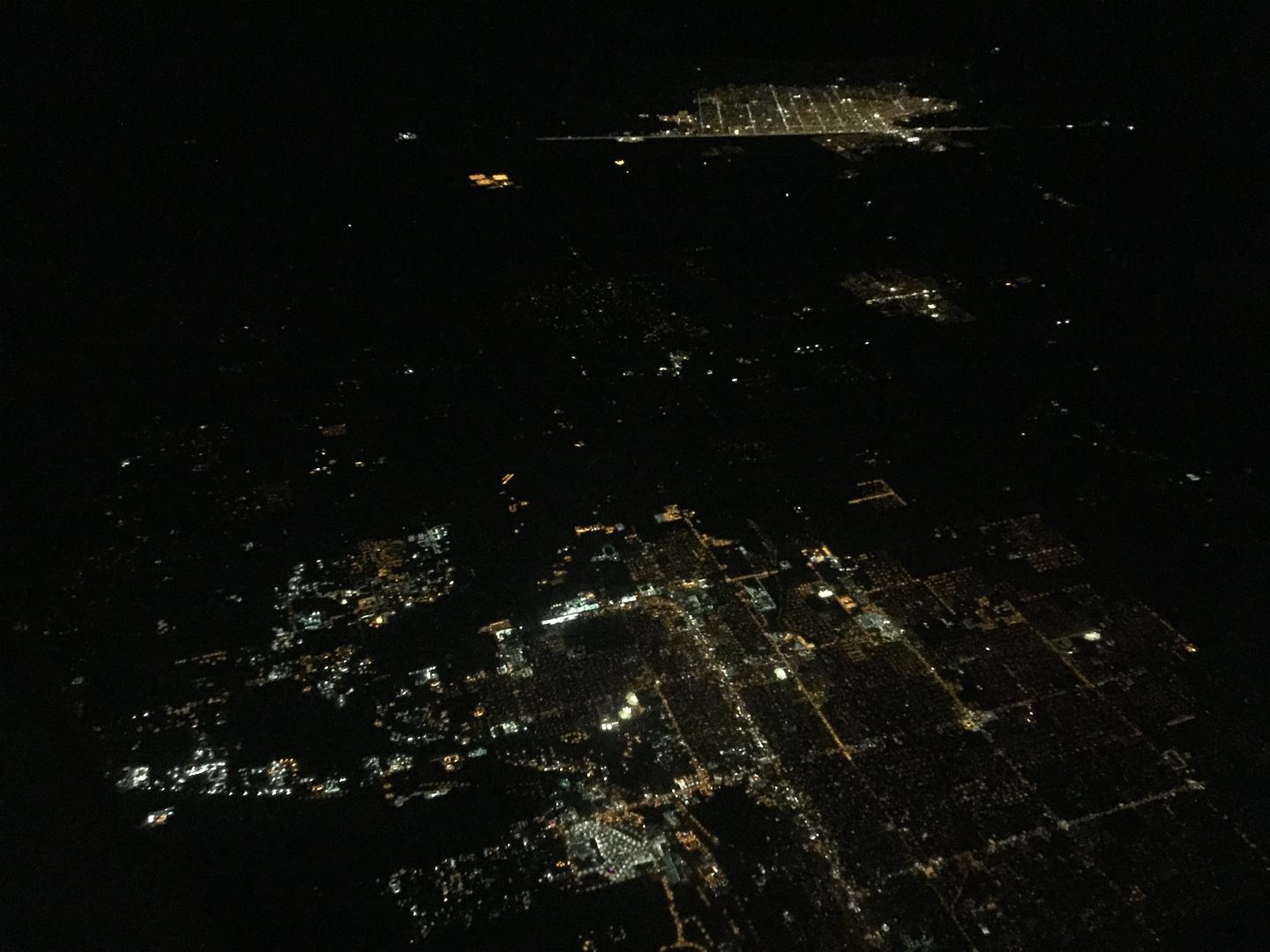
 I believe that the bottom of the photo shows Winterhaven, California - located just west of Yuma, Arizona. Notice that at the top of the pic there's a community that has a straight light of light that forms an unusual looking boundary. That's likely Los Algodones, Mexico lying just south of the illuminated international border. It is unusual to see a city just stop like that in a straight line.
Here's another example:
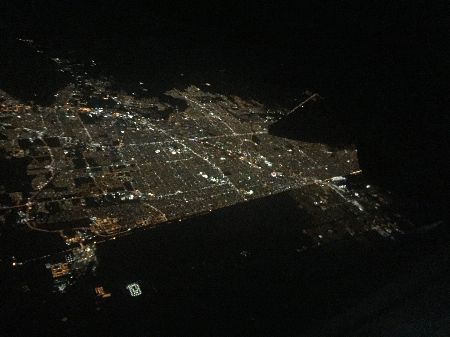
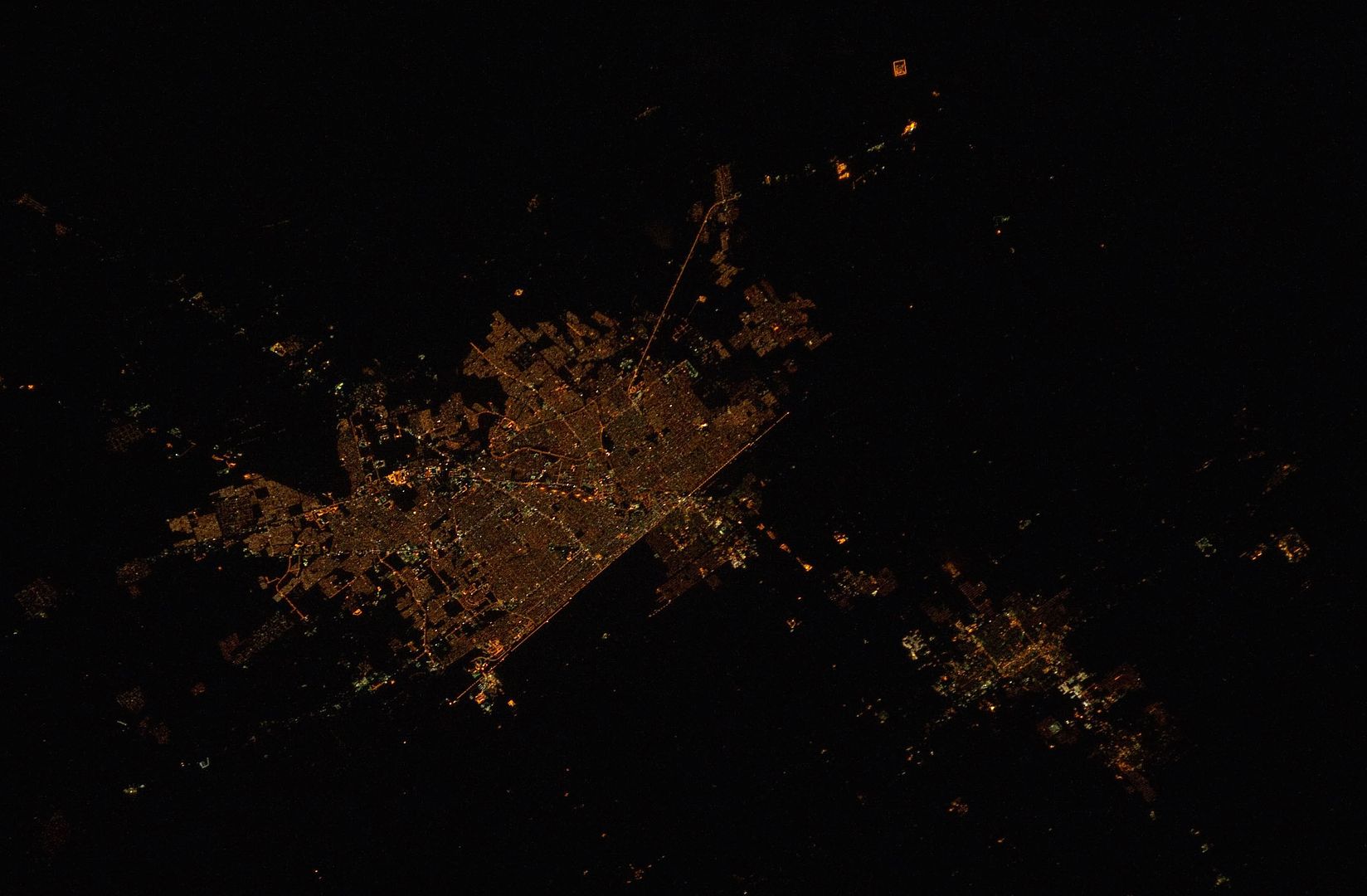
 A short while later we flew even closer to the border and had this view of Mexicali, Mexico (top) and Caliexico, California (lower right). Again, here's a city that stops long the political line and physical fence that separates two countries.
Here's how it looks from the International Space Station:
When I was a kid, I imagined that the lines of geography that we find on maps and globes were real and that you could actually see them. It turns out that my imagination wasn't too far off. The line between Mexicali and Calexico is pretty obvious at night from above.
While we're here, let's check out the last two scenes from space.
 |
| Credit: The Gateway to Astronaut Photography of Earth |
Earlier this week I had a window seat on a night flight from Phoenix Sky Harbor Airport to San Diego's Lindbergh Field. Naturally, I grabbed my iPhone and took pics of the city lights on this flight too.
Like NYC, Phoenix is about to undergo a conversion to LED streetlights. In a couple of years the city should look completely different at night. In spite of the claims that are made, LED streetlights are likely to create more light pollution than what is already in place.
While I enjoyed seeing Phoenix at night, I was more interested in seeing the U.S. - Mexico border.
Here's another example:
Here's how it looks from the International Space Station:
 |
| Credit: The Gateway to Astronaut Photography of Earth |
Sunday, July 20, 2014
U.S.-Mexico Border at Night from Space
Today is the 45th anniversary of the Apollo 11 landing on the Moon. The Apollo program tested our technological abilities and taught us a great deal not only about the Moon, but the entire solar system. The program also gave us a unique perspective on our own world and allowed us to see it in its entirety for the very first time.
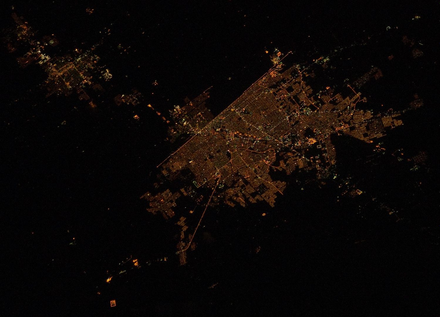
Today, our astronauts don't voyage as far from home, but they still are giving us interesting views of our home world. Here's an example - a nighttime photo from the International Space Station showing portion of the U.S.-Mexico border:
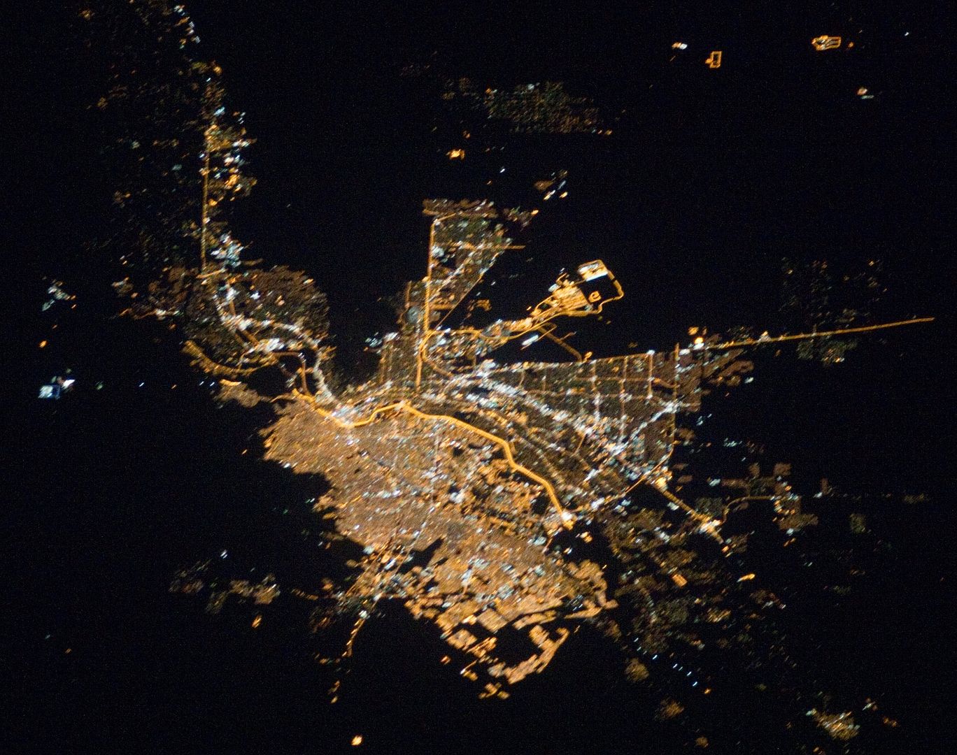
It is a pretty interesting shot as the U.S.-Mexico border is clearly illuminated and the two cities along the border, Calexico in the U.S. and Mexicali in Mexico, are so radically different. The U.S. Mexico border is also illuminated between San Diego and Tijuana. Here's a shot from ISS showing Juarez, Mexico (left) and El Paso, Texas with the wiggly, orange illuminated border between them.
Again, the character of the two cities is remarkably different. There is a lot that can be learned by looking at nighttime views of
cities from around the world.

My Cities from Space posts are the most popular ones on my blog and some of the readers here will be interested knowing that there's a new citizen science project called Cities at Night that has an amazing database of such images from the International Space Station. The project aims to teach people about light pollution and to crowd source classification of the nighttime images taken by the astronauts. Be sure to check it out.
Today, our astronauts don't voyage as far from home, but they still are giving us interesting views of our home world. Here's an example - a nighttime photo from the International Space Station showing portion of the U.S.-Mexico border:
 |
| Image from ISS Expedition 30 Crew. Credit: Earth Science and Remote Sensing Unit, NASA-Johnson Space Center. The Gateway to Astronaut Photography of Earth. |
 |
| Image from ISS Expedition 26 Crew. Credit: Earth Science and Remote Sensing Unit, NASA-Johnson Space Center. The Gateway to Astronaut Photography of Earth. |
My Cities from Space posts are the most popular ones on my blog and some of the readers here will be interested knowing that there's a new citizen science project called Cities at Night that has an amazing database of such images from the International Space Station. The project aims to teach people about light pollution and to crowd source classification of the nighttime images taken by the astronauts. Be sure to check it out.
Sunday, June 1, 2014
A Shameless Plug and A Sunset
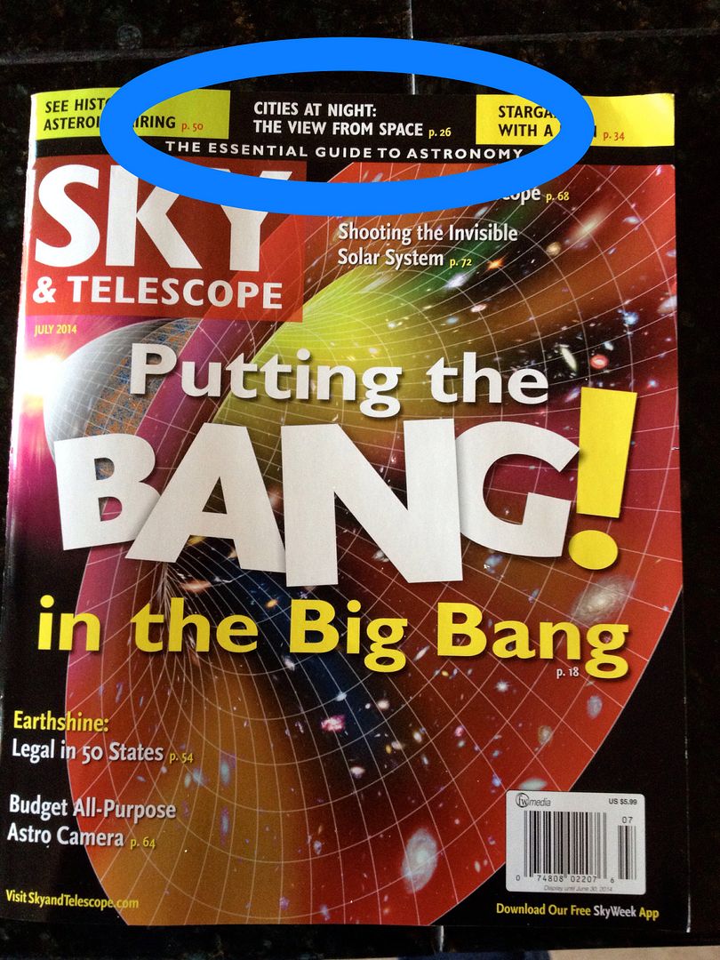
Hey, it's June. That means that the July issue of Sky & Telescope magazine is now out. I've got an article in the issue on light pollution and how cities look from space at night. Here's what the cover looks like (with an oval to highlight my article):
 I've been reading S&T since I was around 14, so it is a nice feeling to have an article of my own show up in print. If you get the chance to read it, feel free to let me know what you think. I've blogged here before on the view of cities from space and these posts are the most popular ones on my blog.
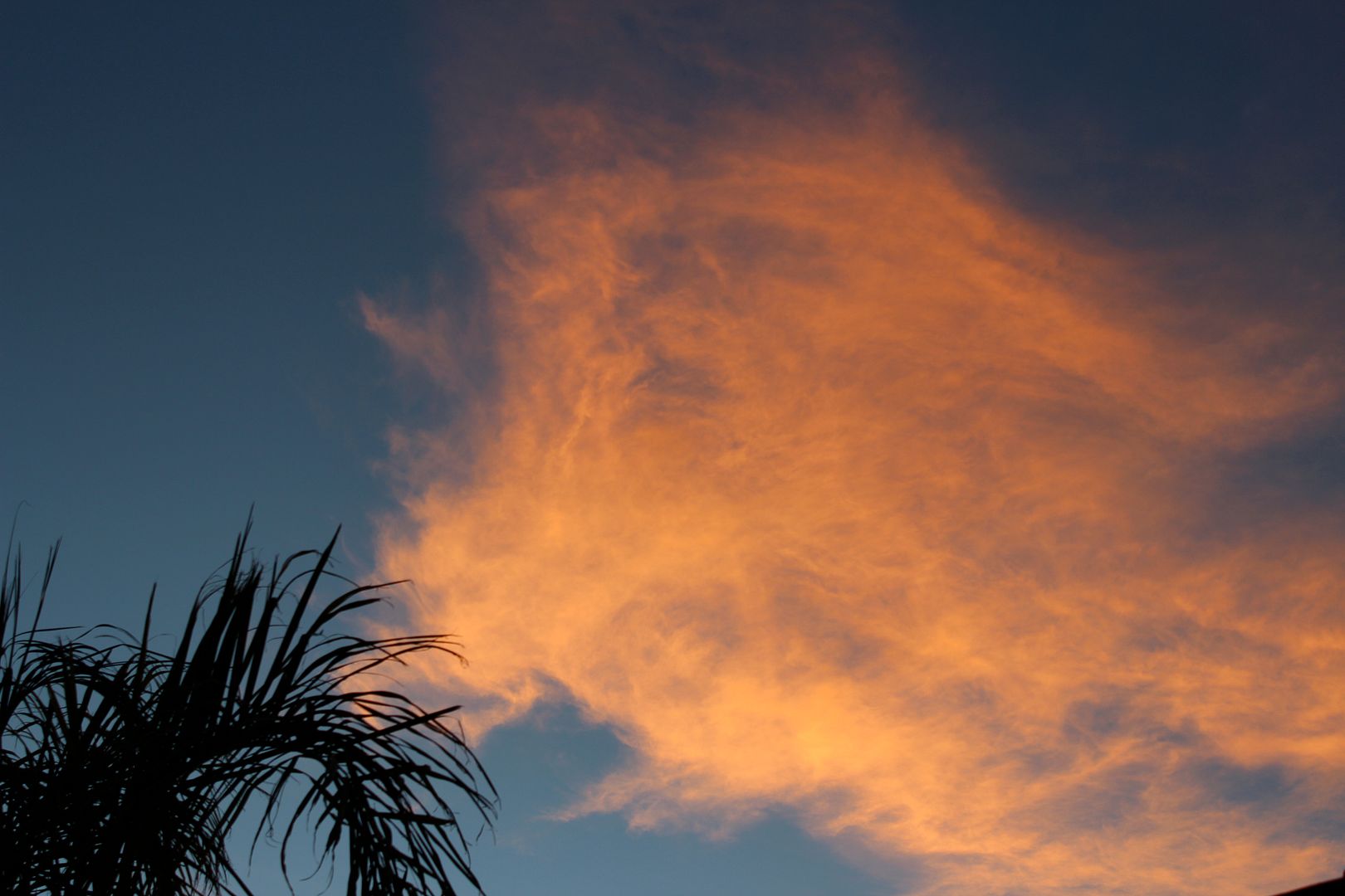
Changing the subject, we had a beautiful sunset this evening to kick off the new month. The high level cirrus clouds we shining with a lovely orange glow, making a vivid contrast against the blue sky.
 In spite of it being crazy hot in Tucson right now, the was a nice beginning to the month.
Changing the subject, we had a beautiful sunset this evening to kick off the new month. The high level cirrus clouds we shining with a lovely orange glow, making a vivid contrast against the blue sky.
Sunday, November 10, 2013
Night Flight II
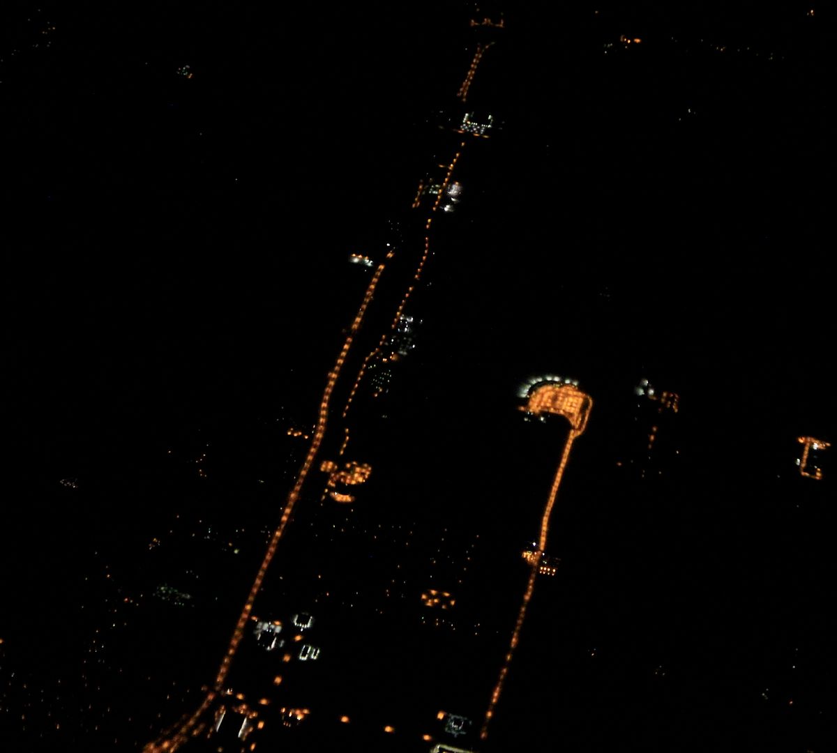
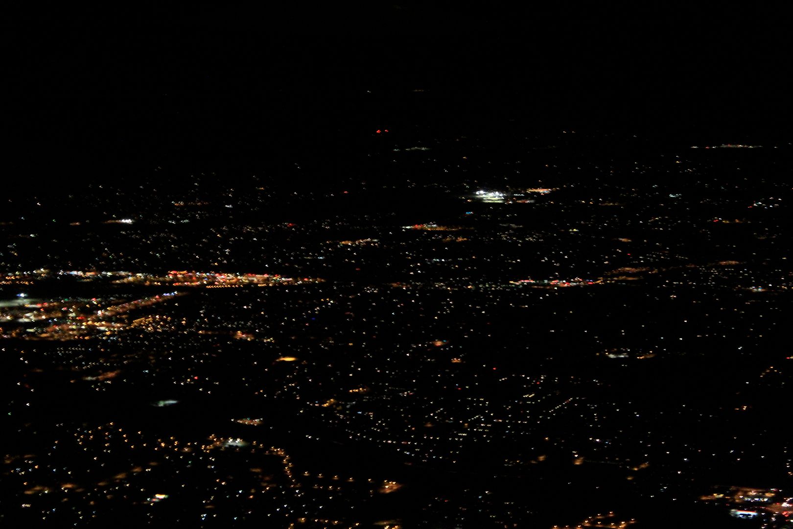
A week ago I had another opportunity to shoot some city lights from an airplane. This time my flight was from Atlanta to Tucson. Unfortunately, it is difficult to know where I was when these shots were taken but there are still some some things of interest in them.

Back to my shots. They are presented in geographic order from east to west.
 Looking down on some continuous roadway lighting:
 Notice the brightest areas in the shot below? Yeah, it's sports lighting
 Finally, two shots of Tucson:
 Notice in the shot above not only the differing colors of light but also that mostly you see the reflected pools of light underneath the light poles rather than upward directed light.

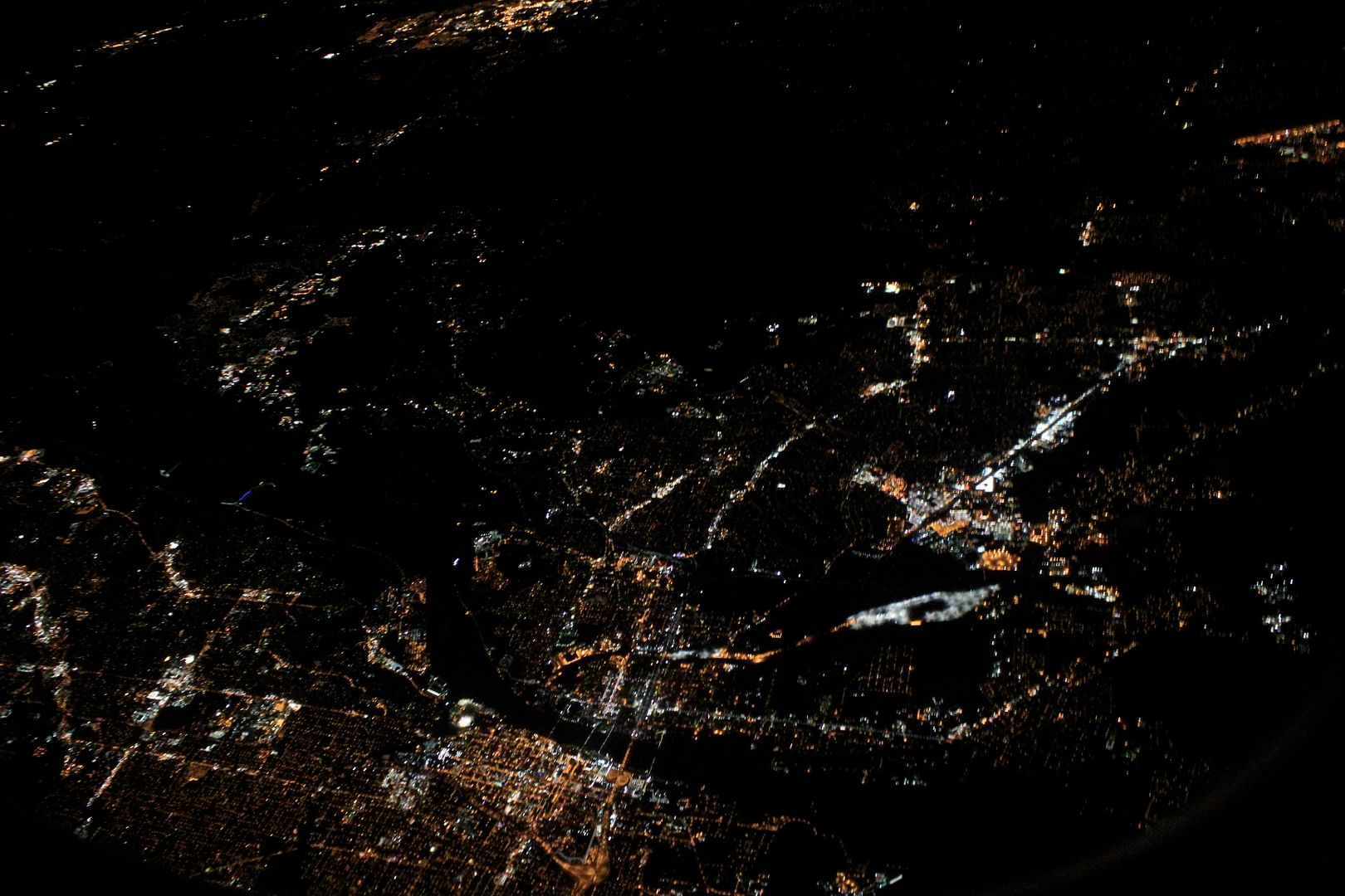
As it turns out there is a lot that can be learned by looking a city lights from the air. Doing so from an airline isn't necessarily the best way to do it though. Some researchers are using airplanes to study city lights in a systematic way. Check out this post about the lights of Berlin from the Loss of the Night blog. They've got a video posted there that I have embedded below that shows their night views of Berlin Germany from an airplane and from the International Space Station:
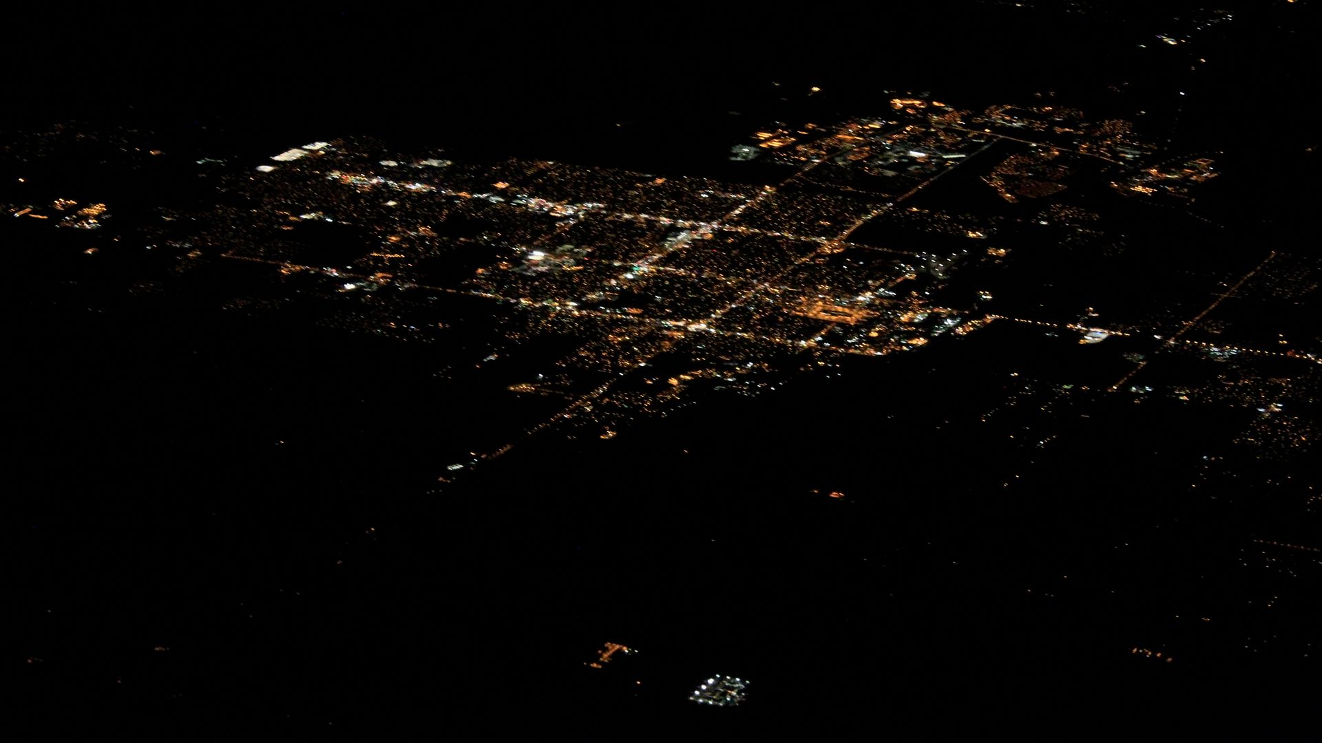
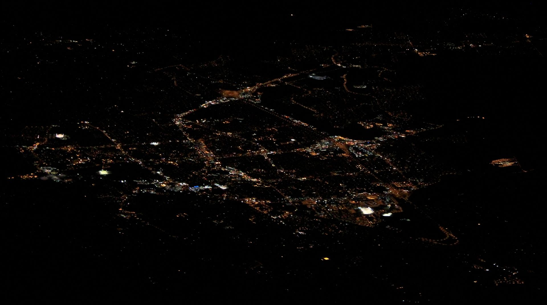
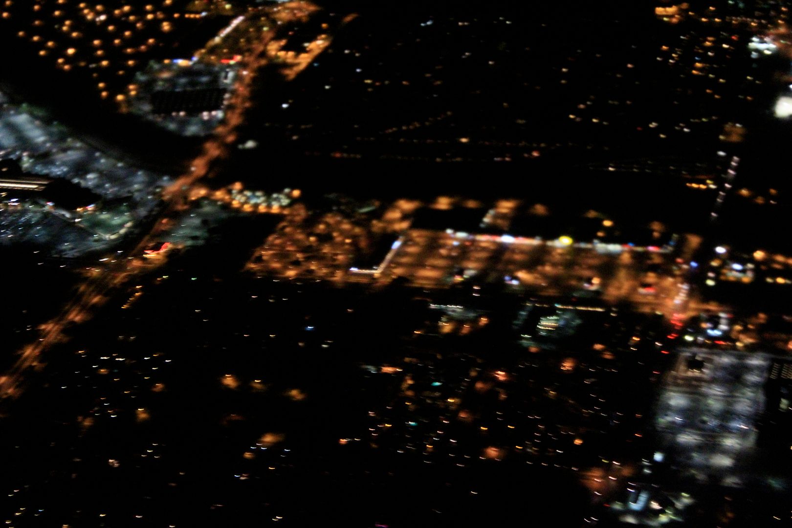
What's the brightest thing in this shot? Sports lighting, just as it is in most towns. This particular installation is putting a lot of light going not directly upward (aside from reflected light), but upward in a sideways direction. Research shows that this brightens the sky over a much larger area. That's not exactly a good thing, is it?
Sunday, October 13, 2013
Night Flight
Last night I finally had the right confluence of flying at night, a window seat, cloudless skies, and having my DSLR handy. Here are some of my shots.
I was on a flight from Dallas/Fort Worth to Tucson when I captured these shots.
They aren't as good as I was hoping for, but I hope aren't too bad. The
motion of the plane (and the photographer), combined with the optically
poor window glass of commercial airlines and the internal lights within
the plane, made getting the shots pretty difficult.
My knowledge of the Dallas/Fort Worth area is pretty limited but it is easy to pick out sports lighting. There are four fields in the shot above and one in the shot below. Both were taken from a high enough altitude that you shouldn't be seeing glare from the fields, yet there it is - light pointing upwards. Poorly directed sports lighting contributes not only to sky glow (lighting up the underside of airplanes) but also light trespass that can disrupt neighborhoods for miles around.
Much of the light in these photos (and in almost all cities) is misdirected and could be improved. Doing so would save energy, lessen the impact of light on the nighttime environment, improve visibility and reduce light pollution. To learn more, check out the website of the International Dark-Sky Association.
What is this?
From 30,000 it is difficult to tell, especially since I don't know where the plane was when the shot was taken.
Unfortunately as we came towards Tucson all electronic devices had to be turned off.
I only got this one, bad shot (above). Sometime I hope to get some good night shots here, but last night wasn't it.
If you like any of these shots you check out my Cities From Space posts, they are the most popular on my blog (much more popular than my Star Trek posts which will continue again soon).
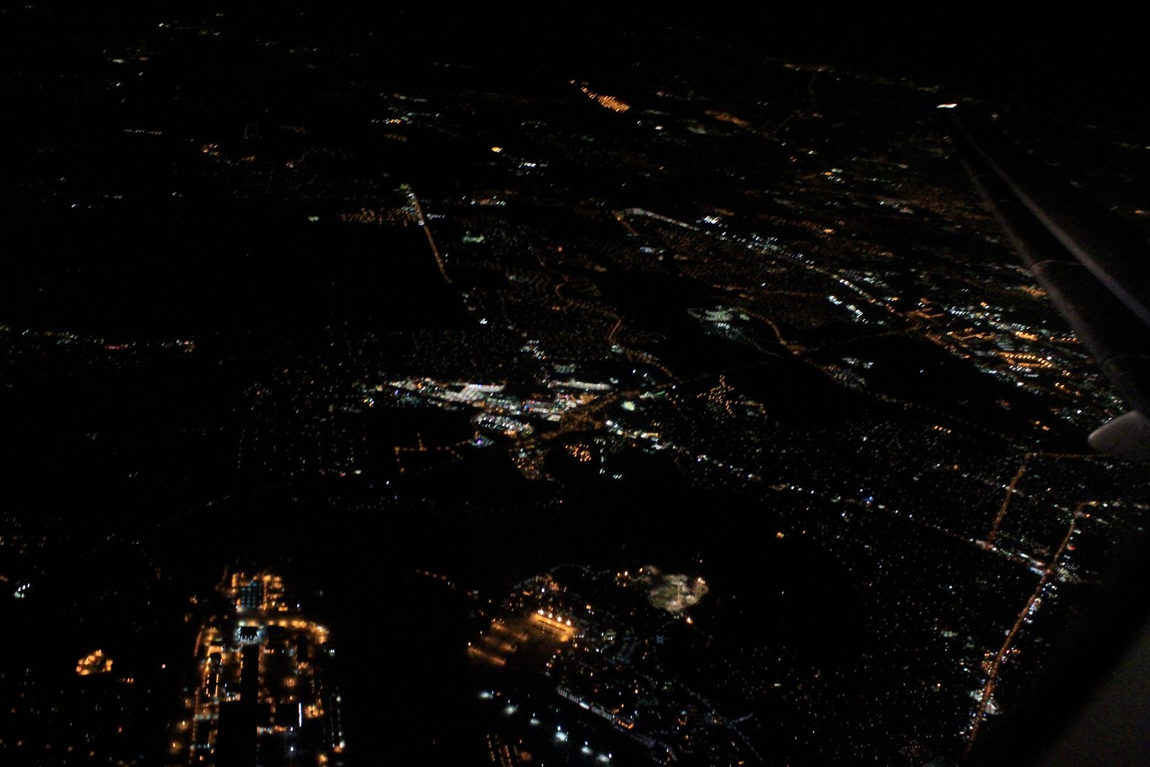 |
| Canon 3Ti 50mm 1/10 Sec., ISO 6400 |
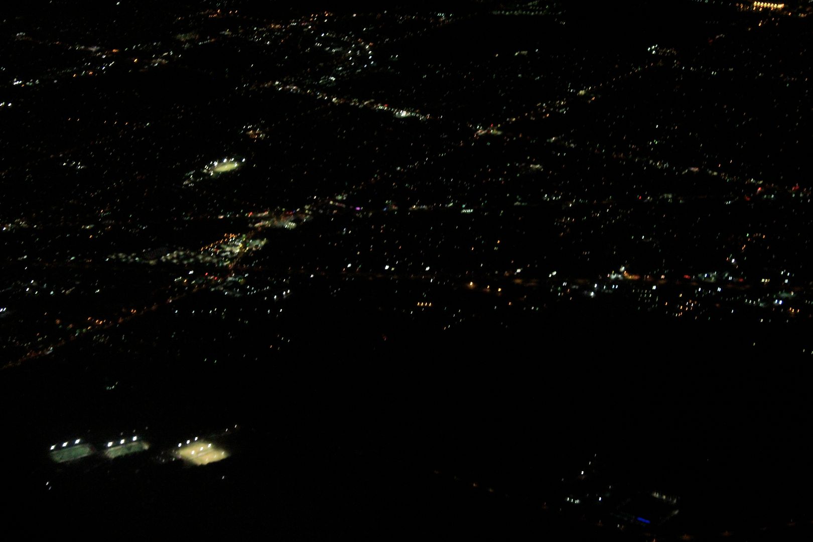 |
| Canon 3Ti 50mm 1/25 Sec., ISO 6400 |
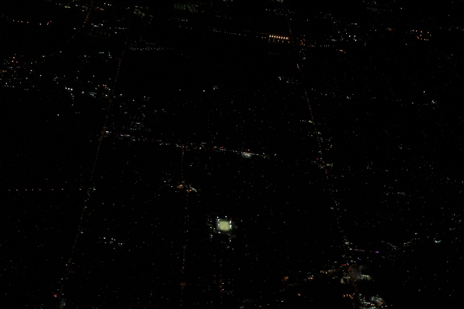 |
| Canon 3Ti 50mm 1/50 Sec., ISO 6400 |
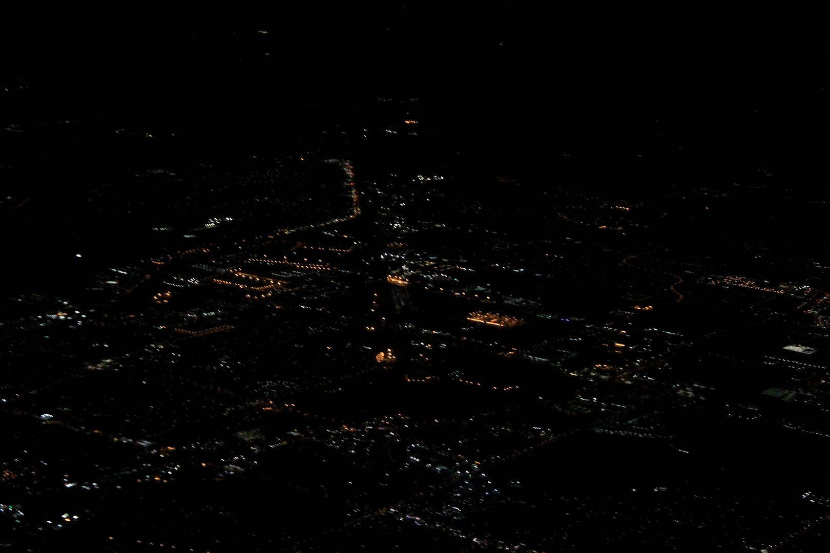 |
| Canon 3Ti 50mm 1/30 Sec., ISO 6400 |
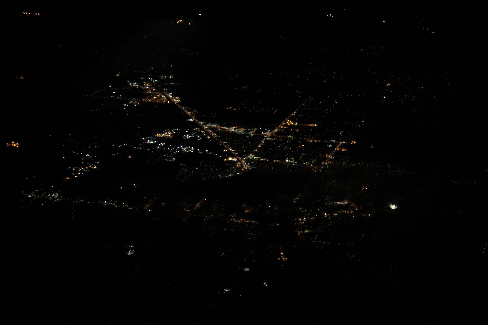 |
| Canon 3Ti 50mm 1/10 Sec., ISO 6400 |
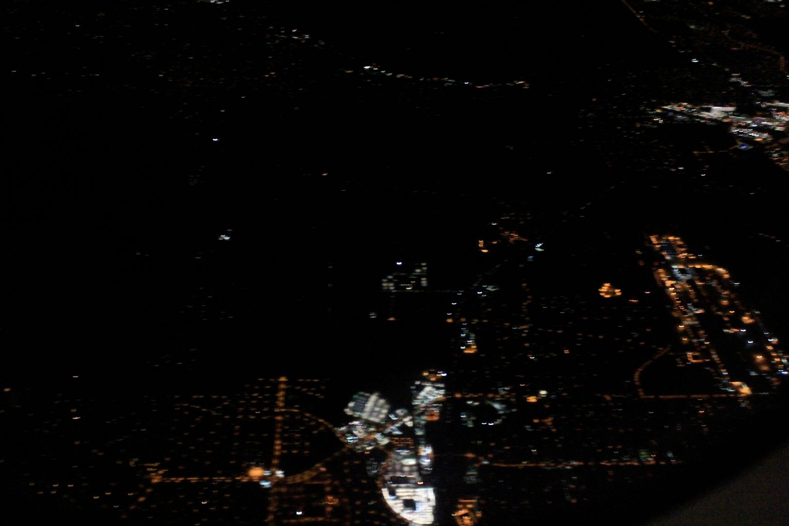 |
| Canon 3Ti 50mm 1/10 Sec., ISO 6400 |
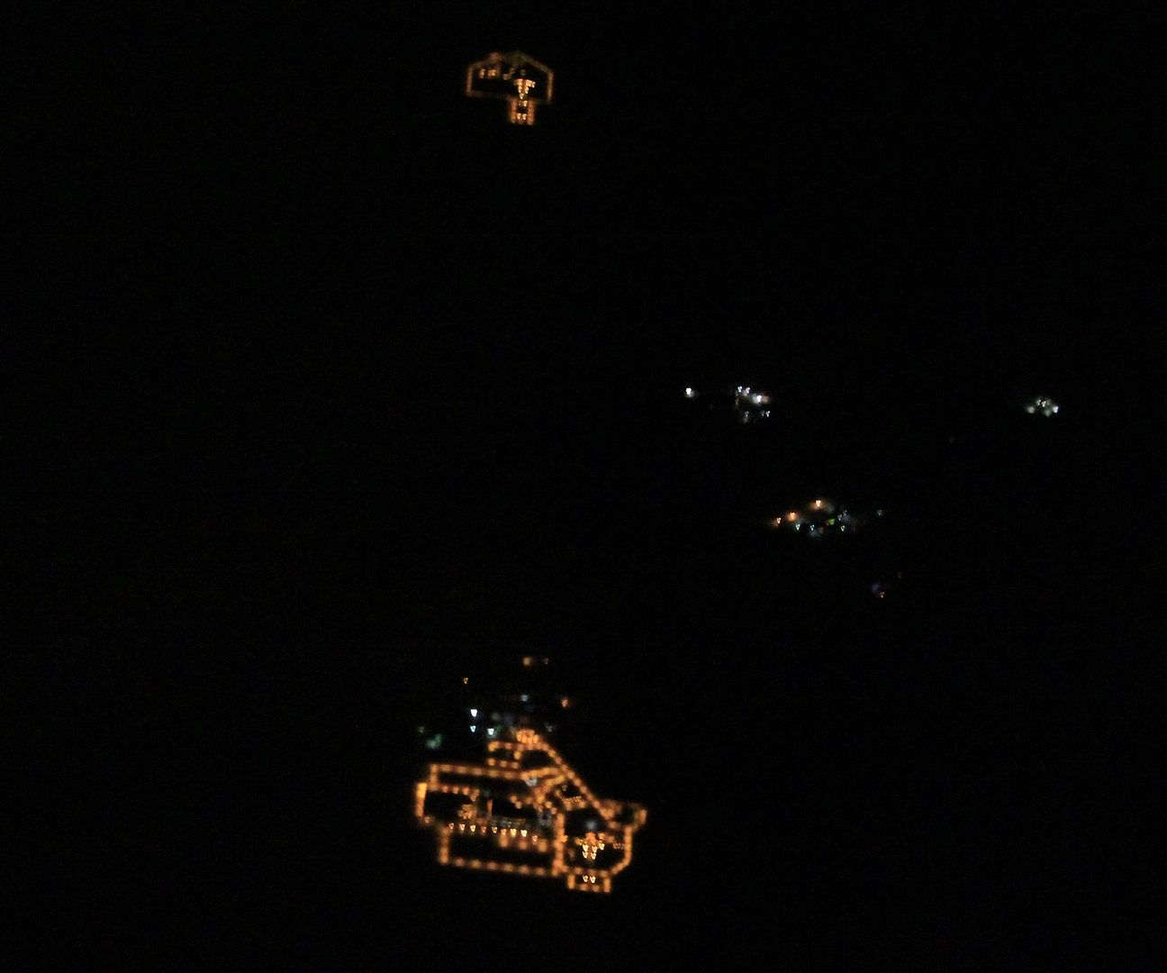 |
| Canon 3Ti 50mm 1/10 Sec., ISO 6400, cropped. |
Unfortunately as we came towards Tucson all electronic devices had to be turned off.
 |
| Canon 3Ti 50mm 1/10 Sec., ISO 6400 |
If you like any of these shots you check out my Cities From Space posts, they are the most popular on my blog (much more popular than my Star Trek posts which will continue again soon).
Saturday, February 2, 2013
Las Vegas, NV: Crazy Bright or Insanely Crazy Bright?
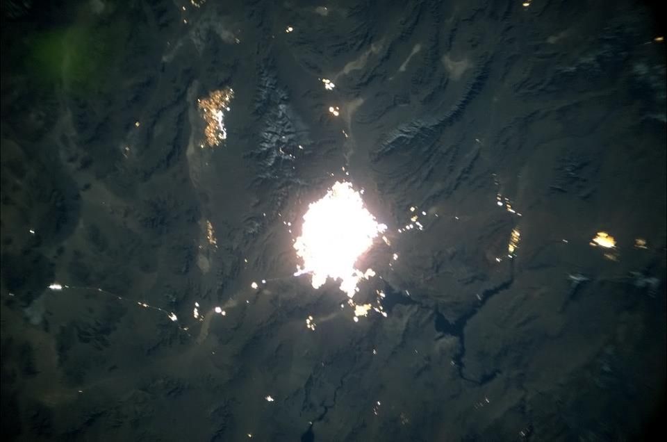
Check out this new view of Las Vegas from Canadian ISS astronaut Commander Chris Hadfield:
 He tweeted/posted this photo on January 23rd saying "here's Las Vegas late at night. Even my NightPod camera found the lights too bright." Yeah, they are too bright indeed.
The guy is all over social media and is posting lots of nighttime and daytime shots of Earth from space, so if you are into that you should follow him and like him and stuff. Find him here on Facebook and on Twitter as @Cmdr_Hadfield. He's on G+ too, but I rarely hang out there and didn't bother to look him up. Sorry.
As for Vegas, there is little or no control of lighting there. The opposite is encouraged. Its glow can be seen on the ground for hundreds of miles away disrupting ecosystems and brightening skies that would otherwise be dark. What shines in Vegas does not stay in Vegas.
My previous post about Las Vegas from December, 2011: Cities From Space - Las Vegas, NV is the most popular one that I have had on this blog, with over 1,700 page views so far. I know, that's not much, but it is a small blog. I also mentioned Vegas in my post Which Cities Have Lighting Controls? You can Spot them from Space.
The guy is all over social media and is posting lots of nighttime and daytime shots of Earth from space, so if you are into that you should follow him and like him and stuff. Find him here on Facebook and on Twitter as @Cmdr_Hadfield. He's on G+ too, but I rarely hang out there and didn't bother to look him up. Sorry.
As for Vegas, there is little or no control of lighting there. The opposite is encouraged. Its glow can be seen on the ground for hundreds of miles away disrupting ecosystems and brightening skies that would otherwise be dark. What shines in Vegas does not stay in Vegas.
My previous post about Las Vegas from December, 2011: Cities From Space - Las Vegas, NV is the most popular one that I have had on this blog, with over 1,700 page views so far. I know, that's not much, but it is a small blog. I also mentioned Vegas in my post Which Cities Have Lighting Controls? You can Spot them from Space.
Monday, January 21, 2013
Wednesday, January 2, 2013
The Persian Gulf. At Night. From Space.
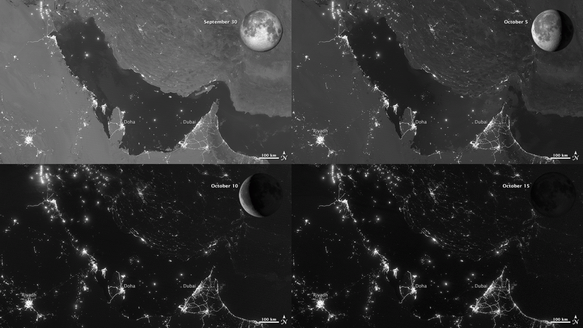
Check it out. Here are four separate nighttime images from space looking down at the same place, but taken under differing amounts of moonlight.
I am not sure what is going on between Riyadh and Doha as there is some apparent motion of the lights, but the overall effect here is that with moonlight it is pretty easy to see the physical features of the Gulf region. The city lights are pretty constant throughout.
For those who haven't noticed, moonlight is indeed pretty bright and the human eye does very nicely under moonlight levels of illumination. It is a shame that we light our cities at the intensity levels that we do, as in many cases it is much more light than we really need.
Check out the full-resolution of the images and learn more from NASA here.
 |
| Images from NASA's Earth Observatory via the Suomi NPP Satellite |
For those who haven't noticed, moonlight is indeed pretty bright and the human eye does very nicely under moonlight levels of illumination. It is a shame that we light our cities at the intensity levels that we do, as in many cases it is much more light than we really need.
Check out the full-resolution of the images and learn more from NASA here.
Sunday, December 30, 2012
Times Square from Space
2012 is nearly over and soon hoards of people (this news account estimates attendance will be a staggering one million people) will gather in Times Square in New York City's Midtown Manhattan to watch the time ball drop at the stroke of midnight as they celebrate the passage of time. It is the world's biggest annual party.
Of course, in Times Square it is a party every night. I had the chance last fall to make my first visit. I wasn't surprised at how bright it was, but as someone who likes peace and quiet and also advocates for light pollution controls, it was a bit of a shock to my system.

 It
is a 24/7 display of giant electronic TV's, excessive lighting and
more. There certainly is a place for this kind of thing in a few places
across the globe but the Times Square ambiance, with over the top
lighting and advertising, is a far cry from what most cities need or
would want. There currently is a lot of pressure from the billboard industry to bring this kind of advertising
to many communities across the U.S. but some groups like Ban Billboard Blight are opposing this.
It
is a 24/7 display of giant electronic TV's, excessive lighting and
more. There certainly is a place for this kind of thing in a few places
across the globe but the Times Square ambiance, with over the top
lighting and advertising, is a far cry from what most cities need or
would want. There currently is a lot of pressure from the billboard industry to bring this kind of advertising
to many communities across the U.S. but some groups like Ban Billboard Blight are opposing this.
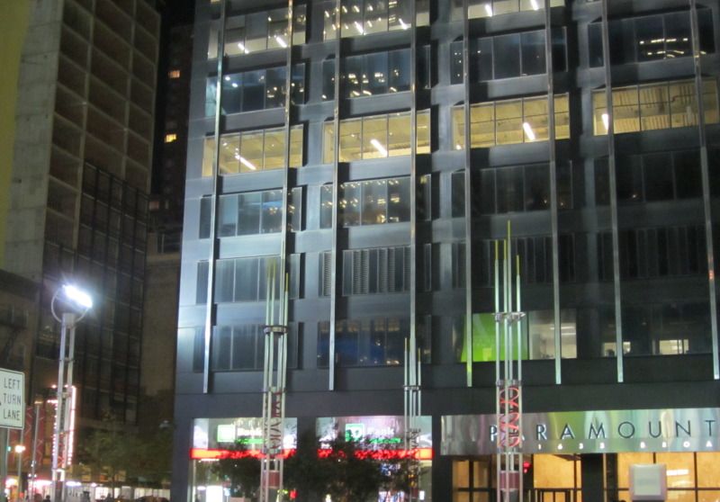
The lighting in Times Square isn't limited to giant video screens. The buildings themselves are generally illuminated too from within and without.
Up light like what is shown above is illegal in communities that have controls on outdoor lighting. I wont argue the "need" for this, but a lot of this light completely misses the target shining up into the sky and not on the buildings at all.
All of this light (from the advertising too) adds up to a lot of light going upwards, which makes Manhattan easy to spot from space at night.
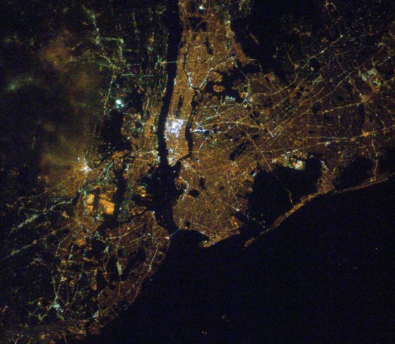
The Expedition 16 crew of the International Space Station captured the above image of Manhattan and the surrounding area the night of February 10, 2008. Can you spot it?
Let's zoom in a bit:

The dark area just left of center is the Hudson River and the one at right is the East River. The dark rectangle near the top is Central Park. The bright area beneath it is Manhattan and Times Square. Compare its brightness to just about everything else in the wide image. Of course, Times Square is all about excess that's why a million people will be there tomorrow night.
 |
| The time ball marks 2012 in Times Square |


The lighting in Times Square isn't limited to giant video screens. The buildings themselves are generally illuminated too from within and without.
 |
| Lights like this one at left shine upward to illuminate buildings. |
All of this light (from the advertising too) adds up to a lot of light going upwards, which makes Manhattan easy to spot from space at night.
 |
| Credit: The Gateway to Astronaut Photography of Earth |
Let's zoom in a bit:

The dark area just left of center is the Hudson River and the one at right is the East River. The dark rectangle near the top is Central Park. The bright area beneath it is Manhattan and Times Square. Compare its brightness to just about everything else in the wide image. Of course, Times Square is all about excess that's why a million people will be there tomorrow night.
Sunday, December 9, 2012
The Black Marble and GLOBE at Night
Did you happen to catch the "Black Marble" images that were released last week?
The images came from the Suomi National Polar-orbiting Partnership satellite and they represent our most detailed look at Earth at night. Chances are you'll be able to spot your home town in these new images wherever it happens to be.
Here's a look at the whole globe:

And here is much of North America:

Most of this represents poorly directed, upward pointing light. It is essentially wasted energy.
These images do not document sky glow - that brightening of the night sky that keeps most of us from seeing faint stars and other sky phenomena. The best way to study sky glow is to measure it from down here on the ground. Thankfully it is easy to measure and document sky glow. A great and easy way for anyone to do so is to participate in the GLOBE at Night program. Be sure to check out their website to see how to get involved. Their first 2013 campaign begins on January 3rd!
Night sky brightness measurements from GLOBE at Night and other programs are an essential tool in documenting light pollution and I urge you to get out there and make some measurements.

The Black Marble - not so black, is it?
The images came from the Suomi National Polar-orbiting Partnership satellite and they represent our most detailed look at Earth at night. Chances are you'll be able to spot your home town in these new images wherever it happens to be.
Here's a look at the whole globe:
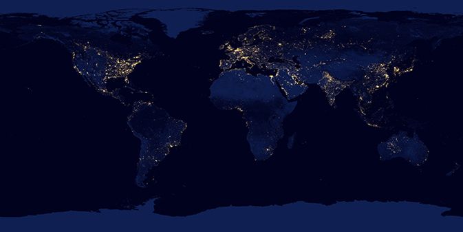
And here is much of North America:
Most of this represents poorly directed, upward pointing light. It is essentially wasted energy.
These images do not document sky glow - that brightening of the night sky that keeps most of us from seeing faint stars and other sky phenomena. The best way to study sky glow is to measure it from down here on the ground. Thankfully it is easy to measure and document sky glow. A great and easy way for anyone to do so is to participate in the GLOBE at Night program. Be sure to check out their website to see how to get involved. Their first 2013 campaign begins on January 3rd!
Night sky brightness measurements from GLOBE at Night and other programs are an essential tool in documenting light pollution and I urge you to get out there and make some measurements.
The Black Marble - not so black, is it?
Tuesday, November 27, 2012
India from Space at Night
In case you missed it, here is an amazing image of India from space at night.
 The image, taken November 12 2012, was published on the NASA Earth Observatory site. The image shows the density of population there. The lights of more than 1.2 billion people are represented here. India has 30 cities with populations over 1 million - imagine how much energy could be conserved if the lights were retrofitted so as to not shine wastefully upward into space.
By the way cities in Bangladesh, Nepal, and Pakistan are also visible near the edges of the image.
There are several high-resolution download options on the NASA site that are worth checking out, including a Google Earth KML file.
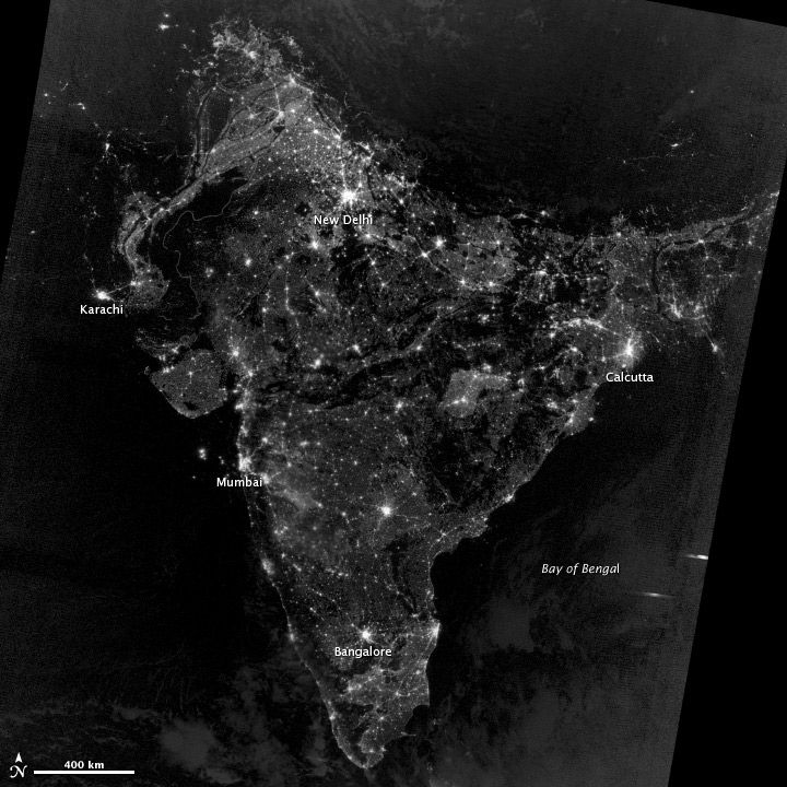
By the way cities in Bangladesh, Nepal, and Pakistan are also visible near the edges of the image.
There are several high-resolution download options on the NASA site that are worth checking out, including a Google Earth KML file.
Sunday, March 18, 2012
Which Cities Have Lighting Controls? You can Spot them from Space.
Yesterday I shared this picture on Facebook & via Twitter:

I guess it made at least somewhat of a splash because it ended up today in the San Diego Union Tribune newspaper. My point was to show the city lights as a discussion point for light pollution, energy waste, etc. No mention of that made it into the paper, although the reporter did point out that I work for the International Dark-Sky Association.
For those who do not recognize the scene below the International Space Station, the coastlines of southwest California and Baja Mexico are visible as well as (from left to right along the coast) the city lights of Tijuana, San Diego and Orange County. The big city well inland is Phoenix, AZ (South is left of up in this view).
Here is another view that covers some of the same geography, but looking almost 180 degrees in a different direction and without the ISS taking up so much of the frame:

This time the Sea of Cortez is in the lower center, with Baja and the lights of the California cities on the left (North is left of up). Also visible inland (from left to right) are Las Vegas, Phoenix and Tucson. Here's an annotated version to help you find them:

You probably already know the answer to this, but which of these cities have lighting controls? Notice that the lights of Las Vegas look white - they have saturated that portion of the camera's electronic detector. Like everything in Las Vegas, its lights are also famous for being over the top. The light polluting sky glow produced there is visible from hundreds of miles away and proves that what is illuminated in Vegas does not stay there.
The brightest city in Arizona, Phoenix, is bigger than Las Vegas. While it is a very large source of light pollution, notice that its core is not a intensely illuminated as that of Vegas. Tucson is certainly bigger than Vegas, but it is much dimmer. That's the result light pollution controls put in place there. The latest revision of Tucson/Pima County Outdoor Lighting Code was put in place just last week and should help to keep Southern Arizona friendly for astronomy for some time to come.
Can you spot Flagstaff? It became the world's first International Dark-Sky City in 2001. It is smaller than Tucson and has even tighter lighting controls. I believe that you'll find it just to the left of the "P" in Phoenix.
Coming back to California, can you tell which cities have lighting controls? Look at the LA & San Diego areas. There is a difference.
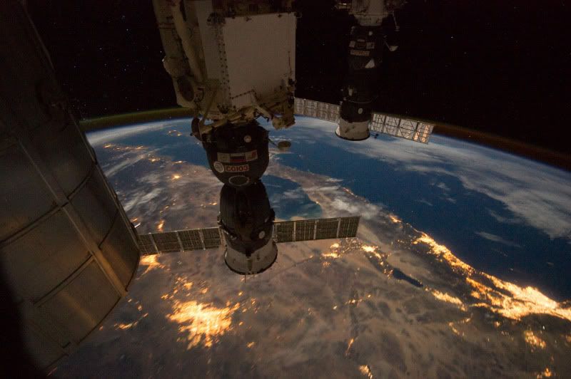
I guess it made at least somewhat of a splash because it ended up today in the San Diego Union Tribune newspaper. My point was to show the city lights as a discussion point for light pollution, energy waste, etc. No mention of that made it into the paper, although the reporter did point out that I work for the International Dark-Sky Association.
For those who do not recognize the scene below the International Space Station, the coastlines of southwest California and Baja Mexico are visible as well as (from left to right along the coast) the city lights of Tijuana, San Diego and Orange County. The big city well inland is Phoenix, AZ (South is left of up in this view).
Here is another view that covers some of the same geography, but looking almost 180 degrees in a different direction and without the ISS taking up so much of the frame:

This time the Sea of Cortez is in the lower center, with Baja and the lights of the California cities on the left (North is left of up). Also visible inland (from left to right) are Las Vegas, Phoenix and Tucson. Here's an annotated version to help you find them:

You probably already know the answer to this, but which of these cities have lighting controls? Notice that the lights of Las Vegas look white - they have saturated that portion of the camera's electronic detector. Like everything in Las Vegas, its lights are also famous for being over the top. The light polluting sky glow produced there is visible from hundreds of miles away and proves that what is illuminated in Vegas does not stay there.
The brightest city in Arizona, Phoenix, is bigger than Las Vegas. While it is a very large source of light pollution, notice that its core is not a intensely illuminated as that of Vegas. Tucson is certainly bigger than Vegas, but it is much dimmer. That's the result light pollution controls put in place there. The latest revision of Tucson/Pima County Outdoor Lighting Code was put in place just last week and should help to keep Southern Arizona friendly for astronomy for some time to come.
Can you spot Flagstaff? It became the world's first International Dark-Sky City in 2001. It is smaller than Tucson and has even tighter lighting controls. I believe that you'll find it just to the left of the "P" in Phoenix.
Coming back to California, can you tell which cities have lighting controls? Look at the LA & San Diego areas. There is a difference.
Saturday, February 11, 2012
A Pass Over North America at Night with Annotated Stills
The videos from the International Space Station keep on coming. The astronauts are now shooting them at the rate of one frame per second, which gives a much closer resemblance to the true speed of the International Space Station than was shown in their previous videos. This sequence was captured January 30, 2012.
I grabbed some of the individual images from the sequence and annotated them to give you some reference points.


The ISS photographed three International Dark Sky Parks in this passage. Can you name them? I will point them out in a follow up post.
I grabbed some of the individual images from the sequence and annotated them to give you some reference points.
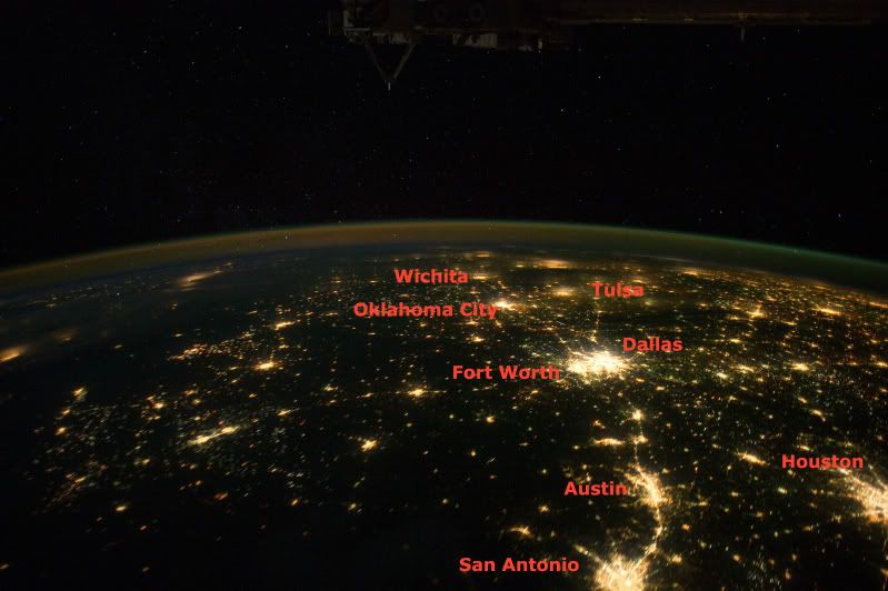
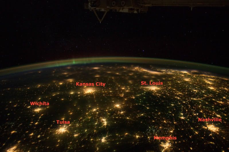
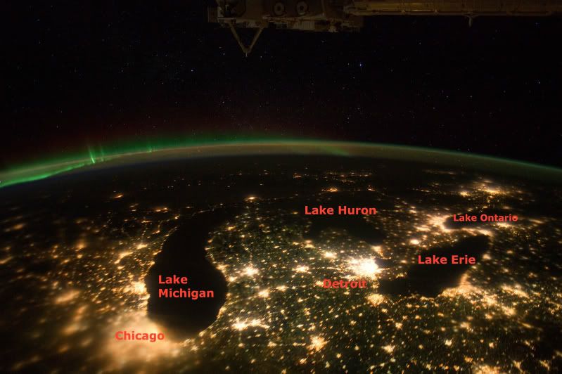
The ISS photographed three International Dark Sky Parks in this passage. Can you name them? I will point them out in a follow up post.
Saturday, December 31, 2011
Cities from Space - End of the tour
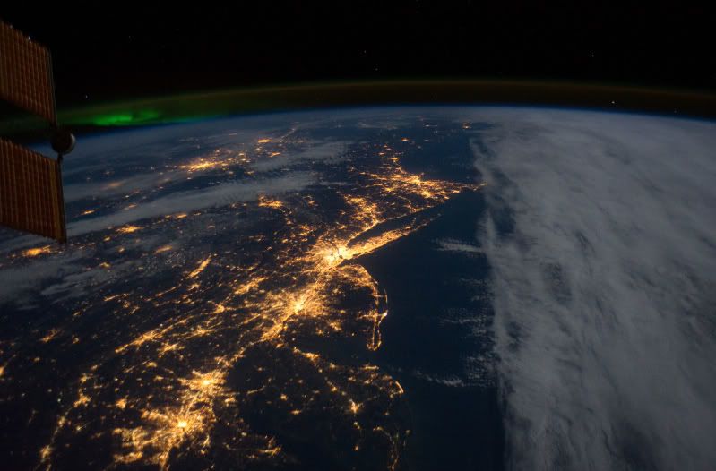
We conclude our orbital tour of light pollution with an image taken on December 11, 2011 (just just 20 days ago) by the Expedition 30 crew of the International Space Station.
The photos shows the northeastern United States - from the top town is New York, NY; Philadelphia, PA; Baltimore, MD and Washington, DC. Just to the right of the bit the space station that is visible is the green glow of the northern lights and the curve of Earth's air glow.
The image was part of a sequence of images that were assembled into this short video sequence:
Another image from the ISS Expedition 30 crew, taken December 4th, shows a wide view of western Europe:

You can see Spain and Portugal, with Lisbon in the foreground near the Atlantic Ocean and Madrid in the middle of Spain. Again, this is part of a longer sequence, this time shot with two cameras, that make this video:
Both the photos and videos show dense, light polluted, population centers.
I hope that you have enjoyed this month-long tour of city lights from space. There are more interesting photos to share and from time to time they'll be posted here.
 |
| Image from NASA's The Gateway to Astronaut Photography of Earth |
The image was part of a sequence of images that were assembled into this short video sequence:
Another image from the ISS Expedition 30 crew, taken December 4th, shows a wide view of western Europe:
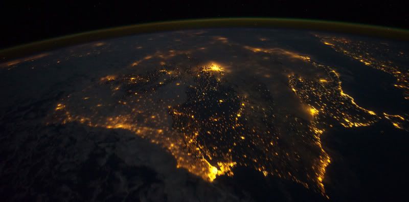
You can see Spain and Portugal, with Lisbon in the foreground near the Atlantic Ocean and Madrid in the middle of Spain. Again, this is part of a longer sequence, this time shot with two cameras, that make this video:
Both the photos and videos show dense, light polluted, population centers.
I hope that you have enjoyed this month-long tour of city lights from space. There are more interesting photos to share and from time to time they'll be posted here.
Friday, December 30, 2011
Cities from Space - Las Vegas, NV
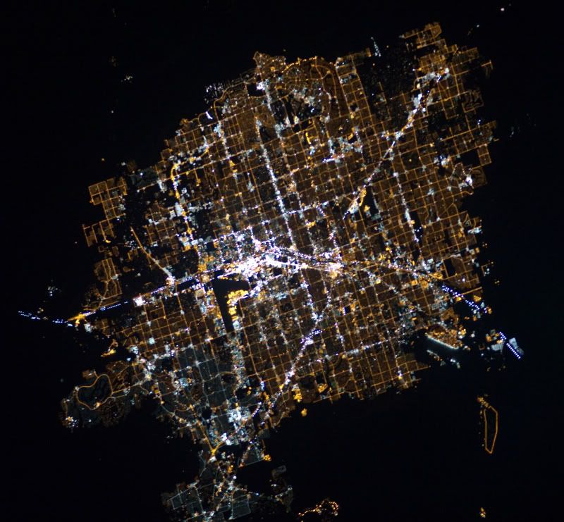
Our orbital tour of cities from space is nearly over. We return to the U.S. for a look at Las Vegas, NV:
Yes, it's Vegas, baby. The image was taken on November 30, 2010 by the Expedition 26 crew of the International Space Station. The Vegas Strip is often cited as being one of the brightest places on Earth, but I cannot confirm that.

Certainly there are no lighting controls where light is beamed up on a regular basis. The Luxor is a light trap that ensnares insects and birds alike with its bright beams. The glow can be seen many miles away in Death Valley. For another nighttime view of Vegas from the ground be sure to check out this GigaPan image.
Check out the video below, Does Las Vegas Care About their Light Pollution?
 |
| Image from NASA's The Gateway to Astronaut Photography of Earth |

Certainly there are no lighting controls where light is beamed up on a regular basis. The Luxor is a light trap that ensnares insects and birds alike with its bright beams. The glow can be seen many miles away in Death Valley. For another nighttime view of Vegas from the ground be sure to check out this GigaPan image.
Check out the video below, Does Las Vegas Care About their Light Pollution?
Subscribe to:
Posts (Atom)