In April, I flew to Newark, New Jersey to attend the Northeast Astronomy Expo (NEAF) and the annual board meeting of the Astronomy Foundation. As I got closer to my destination, darkness was falling and I took advantage of my window seat to take iPhone pics of the city lights below.
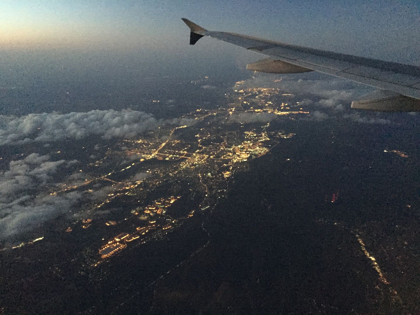 According to the location info that came with the pic, the shot above shows Solcum, Pennsylvania. It was taken in twilight, while it was still light enough to see the wing of the plane, the sky and the clouds illuminated naturally.
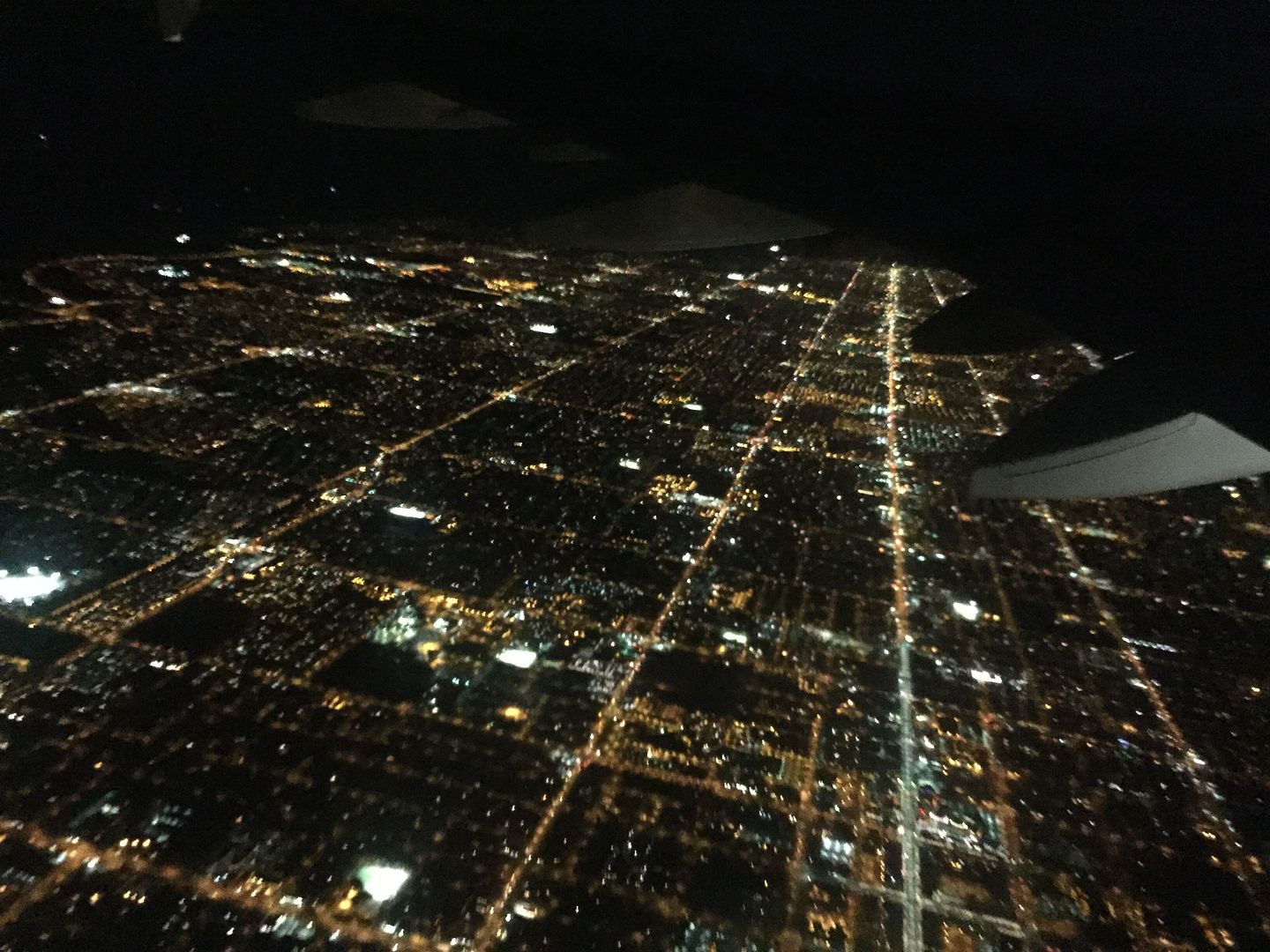
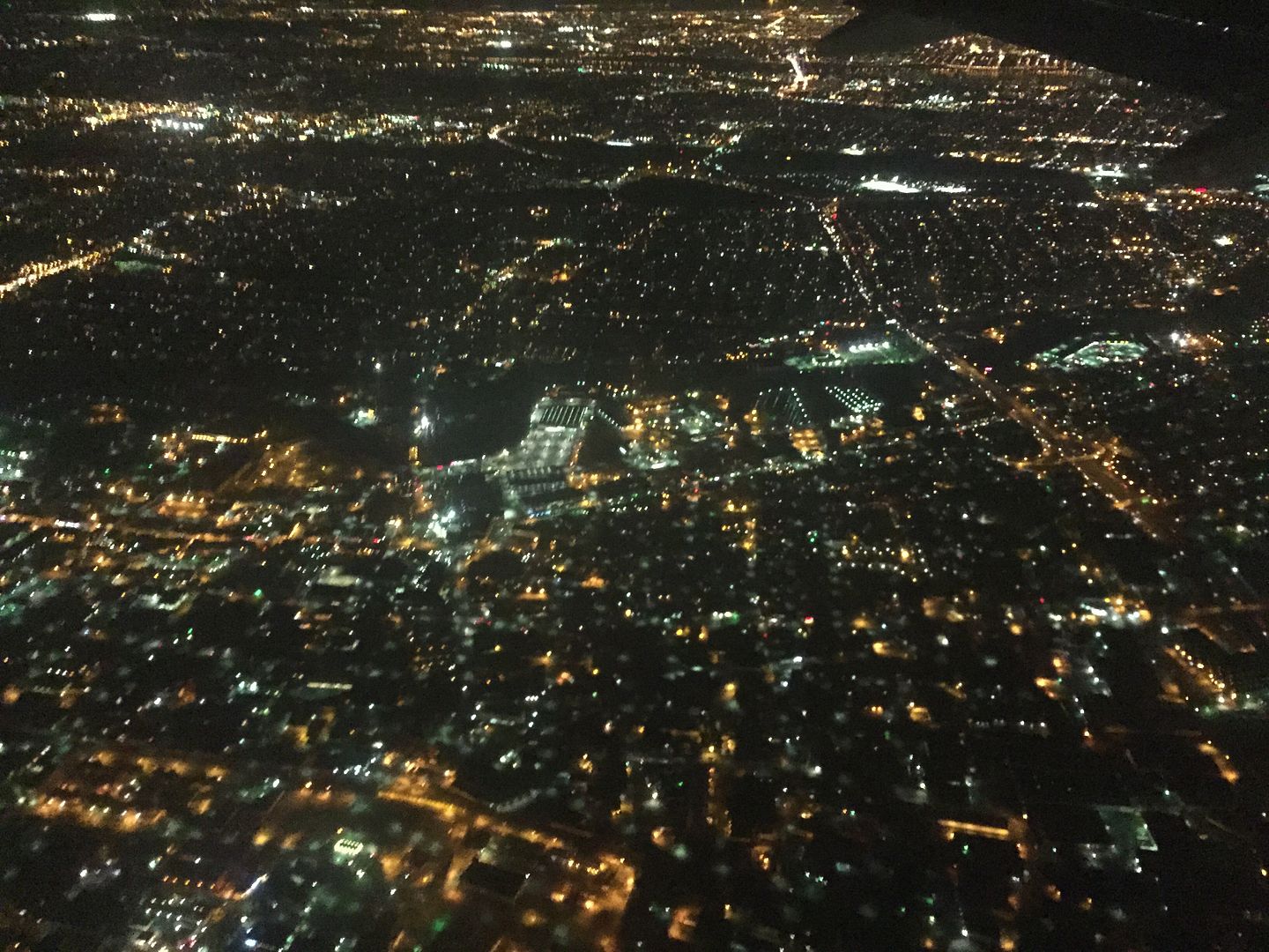 Above, the many lights of Hackensack, New Jersey.
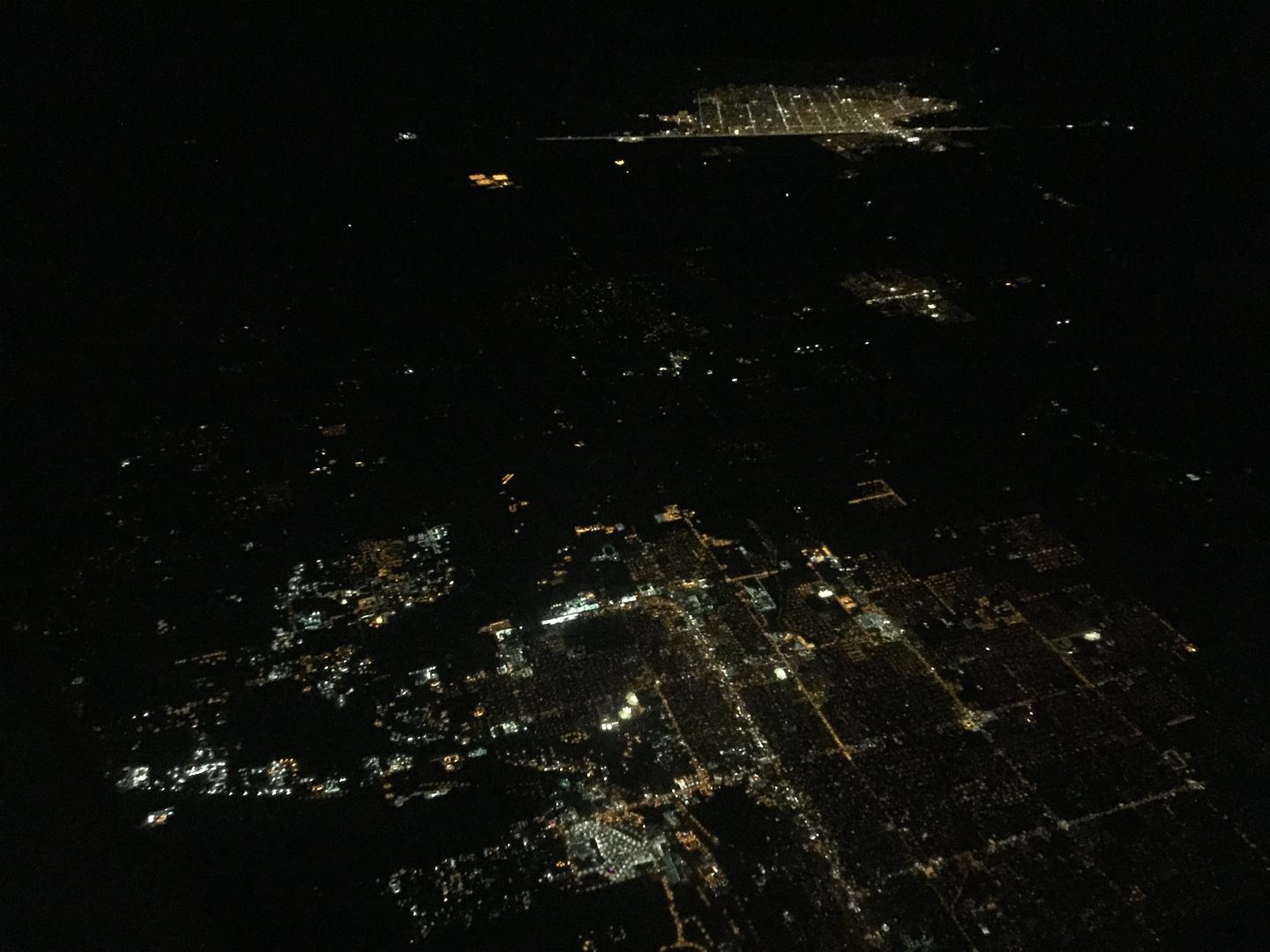
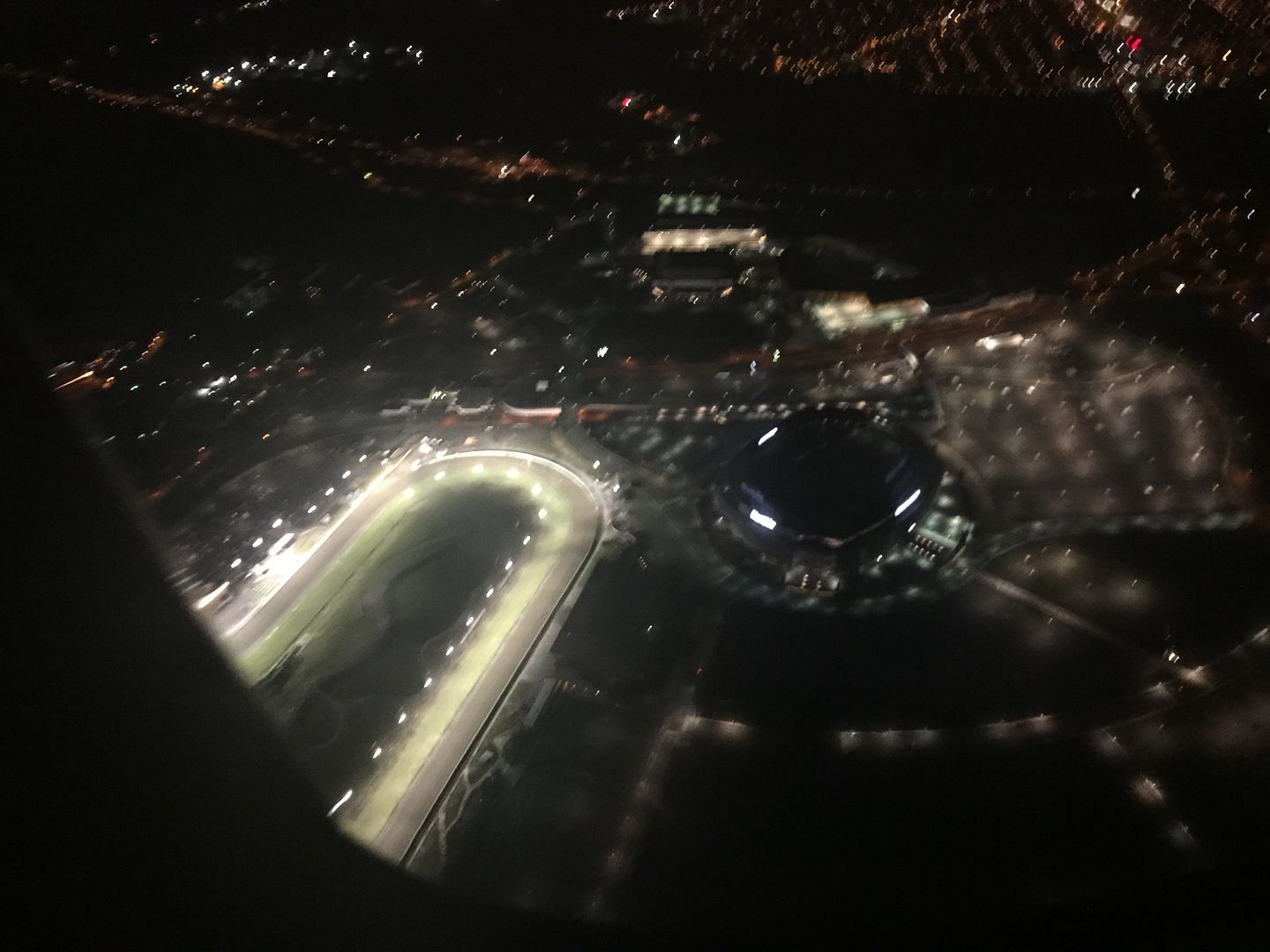 On our approach to Newark, we passed almost directly above the Meadowlands Racetrack. As you can see, it is crazy bright. Which makes sense if, you know, you are racing at night. I didn't see any signs of activity though, which made me wonder why all the lights were turned on. The track is bright enough at night to be seen from space - more on that in a moment.
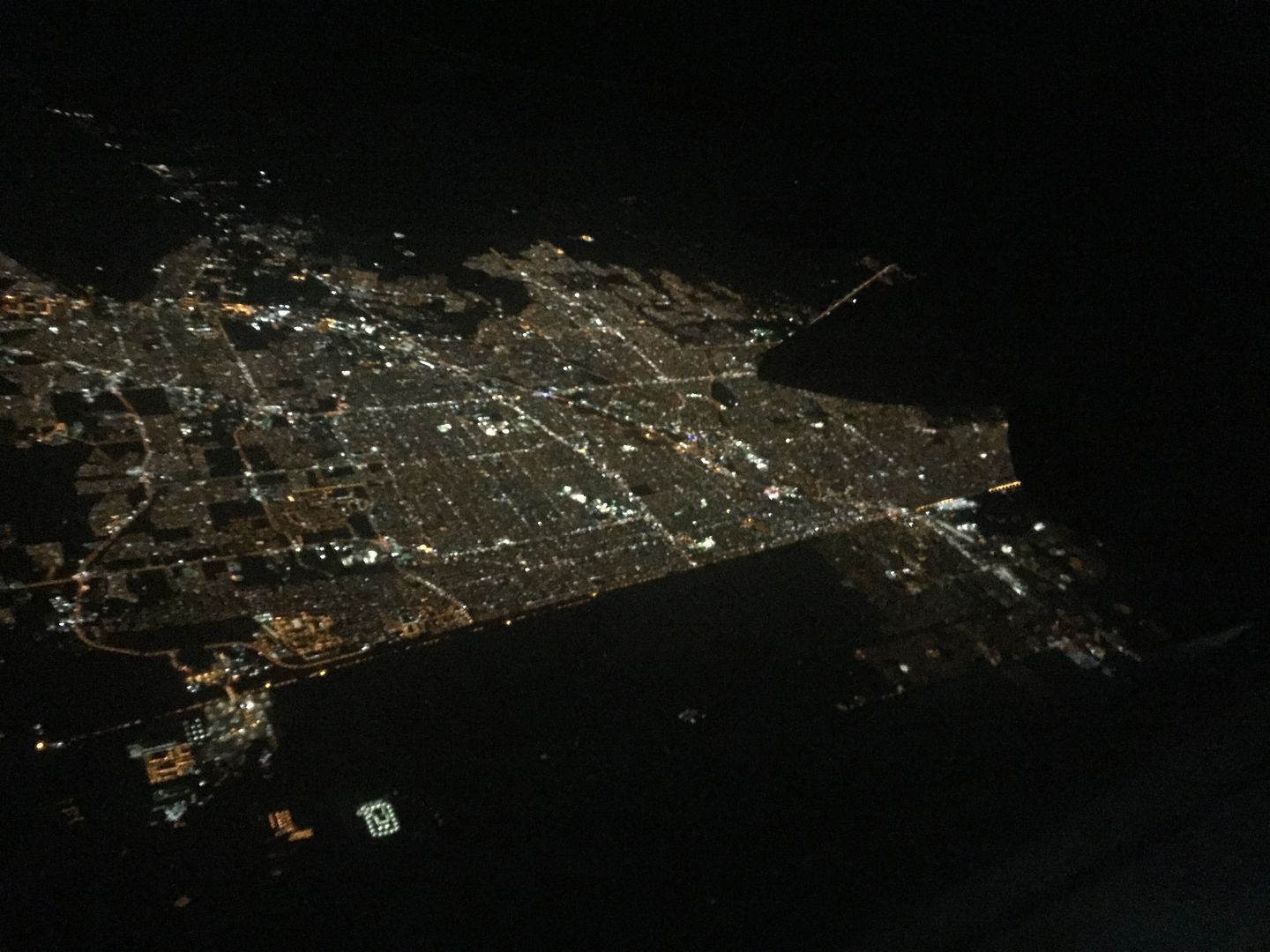
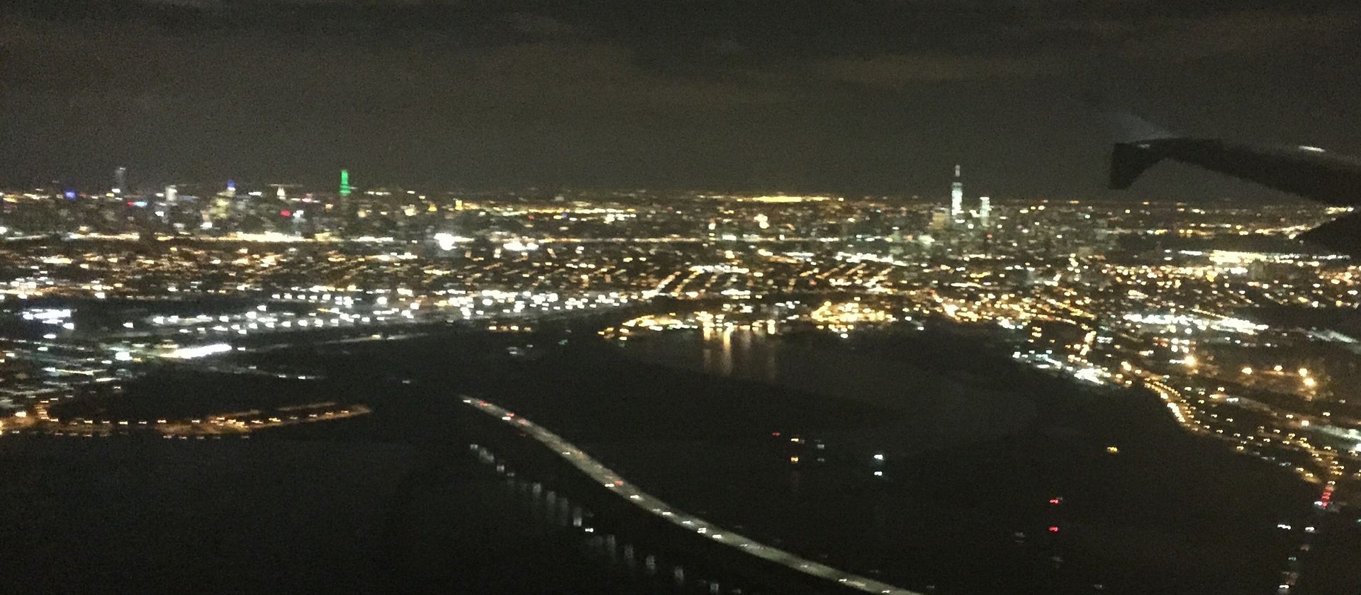 I also had a this great, but not especially close, view of the New York City skyline. That's the Empire State Building near the left lit up in green. My geography of Manhattan is a bit weak, so I leave the identification of the other tall buildings as an exercise to the reader.
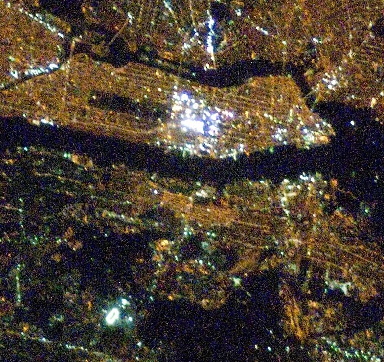
While we're here, let's check out the last two scenes from space.
I used this pic in my Times Square from Space post from a few years ago, but it's worth seeing again. The photo was taken from the International Space Station & I've cropped it from the full frame and North is to the left (sorry). The Meadowlands Racetrack is easily visible as a bright oval in the lower left. Across the dark Hudson River lies the very brightest section of NYC and just to the left of that is the relatively dark rectangle of Central Park. The orange color that is virtually everywhere comes from high-pressure sodium streetlights. NYC is in the process of converting their lights from their existing orange lights to white LED. For good reasons not everybody is happy about it, and it will be interesting to see how the view from space changes as the conversion happens.
Earlier this week I had a window seat on a night flight from Phoenix Sky Harbor Airport to San Diego's Lindbergh Field. Naturally, I grabbed my iPhone and took pics of the city lights on this flight too.
 That's the Phoenix area above. Unlike many cities that grow around many geographic features, the "Valley of the Sun" is laid out in a vast, regular grid pattern that's easily seen here. The occasional bright, white splotches of light are sports fields which are illuminated at much higher levels than other parts of the community. Such sports fields often contain unshielded light and shine light directly upwards creating glare that can be seen from inside aircraft flying at night. Such upward shining light is wasteful and a source of light pollution.
Like NYC, Phoenix is about to undergo a conversion to LED streetlights. In a couple of years the city should look completely different at night. In spite of the claims that are made, LED streetlights are likely to create more light pollution than what is already in place.
While I enjoyed seeing Phoenix at night, I was more interested in seeing the U.S. - Mexico border.
 I believe that the bottom of the photo shows Winterhaven, California - located just west of Yuma, Arizona. Notice that at the top of the pic there's a community that has a straight light of light that forms an unusual looking boundary. That's likely Los Algodones, Mexico lying just south of the illuminated international border. It is unusual to see a city just stop like that in a straight line.
Here's another example:
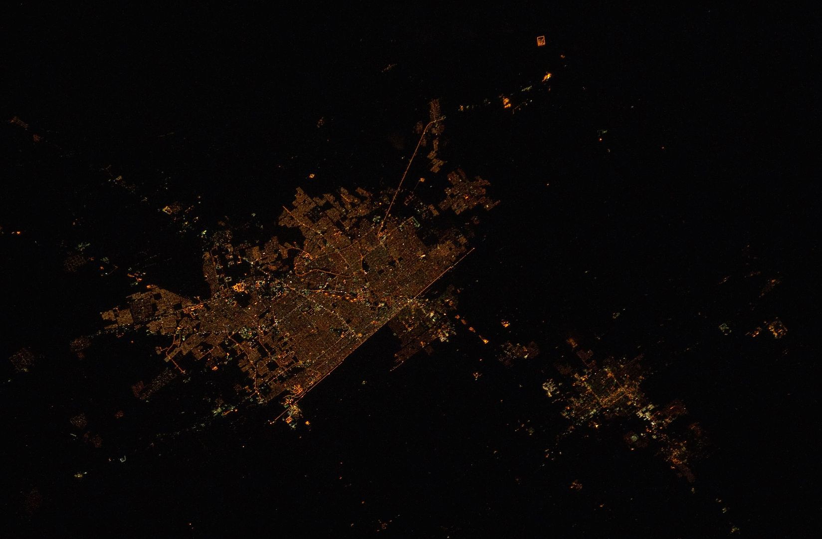
 A short while later we flew even closer to the border and had this view of Mexicali, Mexico (top) and Caliexico, California (lower right). Again, here's a city that stops long the political line and physical fence that separates two countries.
Here's how it looks from the International Space Station:
When I was a kid, I imagined that the lines of geography that we find on maps and globes were real and that you could actually see them. It turns out that my imagination wasn't too far off. The line between Mexicali and Calexico is pretty obvious at night from above.
While we're here, let's check out the last two scenes from space.
 |
| Credit: The Gateway to Astronaut Photography of Earth |
Earlier this week I had a window seat on a night flight from Phoenix Sky Harbor Airport to San Diego's Lindbergh Field. Naturally, I grabbed my iPhone and took pics of the city lights on this flight too.
Like NYC, Phoenix is about to undergo a conversion to LED streetlights. In a couple of years the city should look completely different at night. In spite of the claims that are made, LED streetlights are likely to create more light pollution than what is already in place.
While I enjoyed seeing Phoenix at night, I was more interested in seeing the U.S. - Mexico border.
Here's another example:
Here's how it looks from the International Space Station:
 |
| Credit: The Gateway to Astronaut Photography of Earth |
No comments:
Post a Comment